You are here: Home > Network List > G - GEOSCOPE Stations List
> Station FUTU Maopo'opo, Futuna > Earthquake Result Viewer
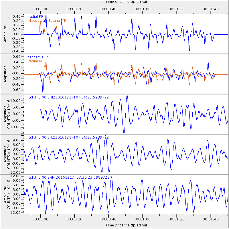
FUTU Maopo'opo, Futuna - Earthquake Result Viewer
*The percent match for this event was below the threshold and hence no stack was calculated.
| Earthquake location: |
Near Coast Of Peru |
| Earthquake latitude/longitude: |
-10.9/-78.8 |
| Earthquake time(UTC): |
2016/12/17 (352) 07:23:30 GMT |
| Earthquake Depth: |
38 km |
| Earthquake Magnitude: |
5.0 mb |
| Earthquake Catalog/Contributor: |
NEIC PDE/us |
|
| Network: |
G GEOSCOPE |
| Station: |
FUTU Maopo'opo, Futuna |
| Lat/Lon: |
14.31 S/178.12 W |
| Elevation: |
97 m |
|
| Distance: |
96.2 deg |
| Az: |
254.199 deg |
| Baz: |
102.845 deg |
| Ray Param: |
$rayparam |
*The percent match for this event was below the threshold and hence was not used in the summary stack. |
|
| Radial Match: |
66.05474 % |
| Radial Bump: |
400 |
| Transverse Match: |
52.08836 % |
| Transverse Bump: |
400 |
| SOD ConfigId: |
1943534 |
| Insert Time: |
2017-01-12 21:13:29.672 +0000 |
| GWidth: |
2.5 |
| Max Bumps: |
400 |
| Tol: |
0.001 |
|
Signal To Noise
| Channel | StoN | STA | LTA |
| G:FUTU:00:BHZ:20161217T07:36:23.598972Z | 0.86905134 | 3.0341223E-6 | 3.4913037E-6 |
| G:FUTU:00:BHN:20161217T07:36:23.598972Z | 2.517691 | 7.3110164E-6 | 2.9038579E-6 |
| G:FUTU:00:BHE:20161217T07:36:23.598972Z | 0.61354953 | 2.4433787E-6 | 3.982366E-6 |
| Arrivals |
| Ps | |
| PpPs | |
| PsPs/PpSs | |


