You are here: Home > Network List > TA - USArray Transportable Network (new EarthScope stations) Stations List
> Station B18K Kokolik River, AK, USA > Earthquake Result Viewer
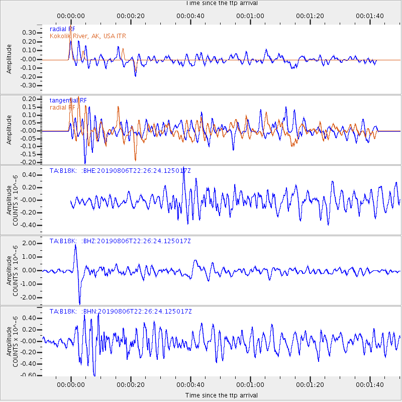
B18K Kokolik River, AK, USA - Earthquake Result Viewer
*The percent match for this event was below the threshold and hence no stack was calculated.
| Earthquake location: |
Vanuatu Islands |
| Earthquake latitude/longitude: |
-18.0/168.6 |
| Earthquake time(UTC): |
2019/08/06 (218) 22:14:14 GMT |
| Earthquake Depth: |
150 km |
| Earthquake Magnitude: |
5.9 Mww |
| Earthquake Catalog/Contributor: |
NEIC PDE/us |
|
| Network: |
TA USArray Transportable Network (new EarthScope stations) |
| Station: |
B18K Kokolik River, AK, USA |
| Lat/Lon: |
69.36 N/161.80 W |
| Elevation: |
222 m |
|
| Distance: |
89.6 deg |
| Az: |
10.075 deg |
| Baz: |
208.009 deg |
| Ray Param: |
$rayparam |
*The percent match for this event was below the threshold and hence was not used in the summary stack. |
|
| Radial Match: |
76.11869 % |
| Radial Bump: |
400 |
| Transverse Match: |
77.99454 % |
| Transverse Bump: |
400 |
| SOD ConfigId: |
19053131 |
| Insert Time: |
2019-08-20 22:21:11.046 +0000 |
| GWidth: |
2.5 |
| Max Bumps: |
400 |
| Tol: |
0.001 |
|
Signal To Noise
| Channel | StoN | STA | LTA |
| TA:B18K: :BHZ:20190806T22:26:24.125017Z | 12.616492 | 9.823427E-7 | 7.786179E-8 |
| TA:B18K: :BHN:20190806T22:26:24.125017Z | 3.711573 | 2.204564E-7 | 5.939703E-8 |
| TA:B18K: :BHE:20190806T22:26:24.125017Z | 1.89392 | 1.1426897E-7 | 6.0334635E-8 |
| Arrivals |
| Ps | |
| PpPs | |
| PsPs/PpSs | |


