You are here: Home > Network List > TA - USArray Transportable Network (new EarthScope stations) Stations List
> Station R33M Jennings River, BC, CAN > Earthquake Result Viewer
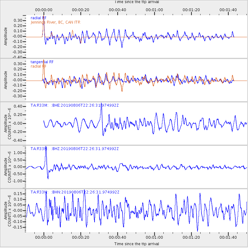
R33M Jennings River, BC, CAN - Earthquake Result Viewer
*The percent match for this event was below the threshold and hence no stack was calculated.
| Earthquake location: |
Vanuatu Islands |
| Earthquake latitude/longitude: |
-18.0/168.6 |
| Earthquake time(UTC): |
2019/08/06 (218) 22:14:14 GMT |
| Earthquake Depth: |
150 km |
| Earthquake Magnitude: |
5.9 Mww |
| Earthquake Catalog/Contributor: |
NEIC PDE/us |
|
| Network: |
TA USArray Transportable Network (new EarthScope stations) |
| Station: |
R33M Jennings River, BC, CAN |
| Lat/Lon: |
59.39 N/130.97 W |
| Elevation: |
1437 m |
|
| Distance: |
91.3 deg |
| Az: |
26.424 deg |
| Baz: |
235.867 deg |
| Ray Param: |
$rayparam |
*The percent match for this event was below the threshold and hence was not used in the summary stack. |
|
| Radial Match: |
74.48106 % |
| Radial Bump: |
395 |
| Transverse Match: |
69.142525 % |
| Transverse Bump: |
400 |
| SOD ConfigId: |
19053131 |
| Insert Time: |
2019-08-20 22:22:41.040 +0000 |
| GWidth: |
2.5 |
| Max Bumps: |
400 |
| Tol: |
0.001 |
|
Signal To Noise
| Channel | StoN | STA | LTA |
| TA:R33M: :BHZ:20190806T22:26:31.974992Z | 8.657907 | 5.161782E-7 | 5.961928E-8 |
| TA:R33M: :BHN:20190806T22:26:31.974992Z | 1.8667909 | 7.900937E-8 | 4.232363E-8 |
| TA:R33M: :BHE:20190806T22:26:31.974992Z | 2.680695 | 1.899823E-7 | 7.087054E-8 |
| Arrivals |
| Ps | |
| PpPs | |
| PsPs/PpSs | |


