You are here: Home > Network List > PF - Volcanologic Network of Piton de Fournaise-OVPF Stations List
> Station GPS Grandes Pentes Sud > Earthquake Result Viewer
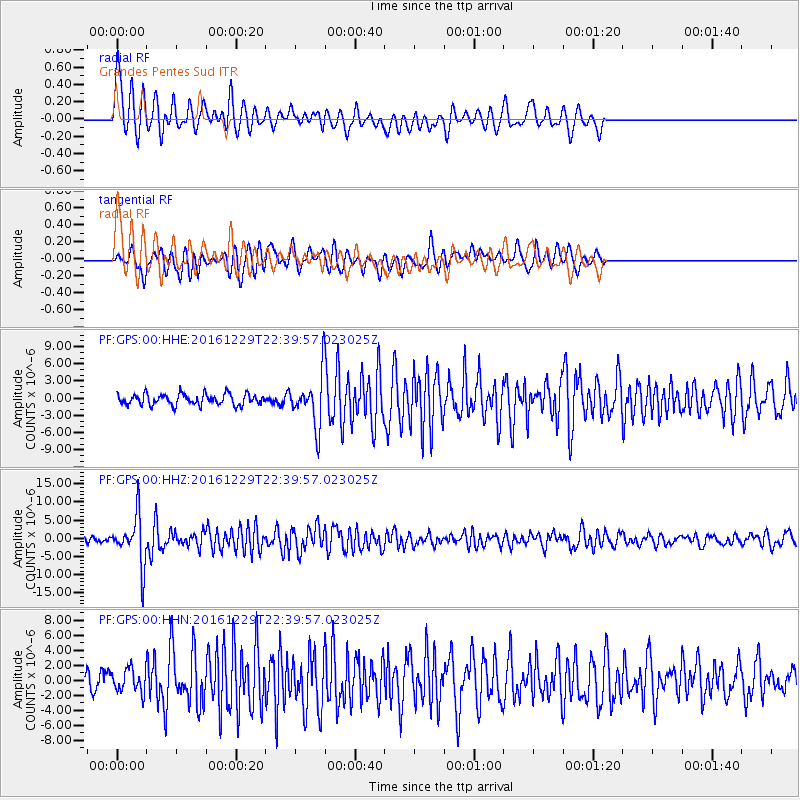
GPS Grandes Pentes Sud - Earthquake Result Viewer
*The percent match for this event was below the threshold and hence no stack was calculated.
| Earthquake location: |
Sumbawa Region, Indonesia |
| Earthquake latitude/longitude: |
-9.1/118.6 |
| Earthquake time(UTC): |
2016/12/29 (364) 22:30:18 GMT |
| Earthquake Depth: |
72 km |
| Earthquake Magnitude: |
6.2 Mwp |
| Earthquake Catalog/Contributor: |
NEIC PDE/us |
|
| Network: |
PF Volcanologic Network of Piton de Fournaise-OVPF |
| Station: |
GPS Grandes Pentes Sud |
| Lat/Lon: |
21.27 S/55.76 E |
| Elevation: |
1004 m |
|
| Distance: |
61.5 deg |
| Az: |
250.768 deg |
| Baz: |
88.923 deg |
| Ray Param: |
$rayparam |
*The percent match for this event was below the threshold and hence was not used in the summary stack. |
|
| Radial Match: |
79.81438 % |
| Radial Bump: |
400 |
| Transverse Match: |
70.48024 % |
| Transverse Bump: |
400 |
| SOD ConfigId: |
1943534 |
| Insert Time: |
2017-01-12 22:32:07.323 +0000 |
| GWidth: |
2.5 |
| Max Bumps: |
400 |
| Tol: |
0.001 |
|
Signal To Noise
| Channel | StoN | STA | LTA |
| PF:GPS:00:HHZ:20161229T22:39:57.023025Z | 10.5211935 | 6.891649E-6 | 6.5502536E-7 |
| PF:GPS:00:HHN:20161229T22:39:57.023025Z | 1.0116197 | 1.5100359E-6 | 1.4926912E-6 |
| PF:GPS:00:HHE:20161229T22:39:57.023025Z | 4.5583963 | 4.353634E-6 | 9.550802E-7 |
| Arrivals |
| Ps | |
| PpPs | |
| PsPs/PpSs | |


