You are here: Home > Network List > UW - Pacific Northwest Regional Seismic Network Stations List
> Station LEBA Lebam, WA, USA > Earthquake Result Viewer
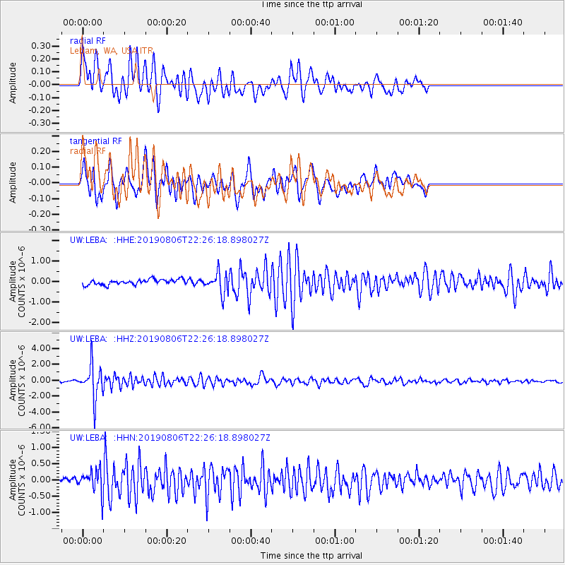
LEBA Lebam, WA, USA - Earthquake Result Viewer
*The percent match for this event was below the threshold and hence no stack was calculated.
| Earthquake location: |
Vanuatu Islands |
| Earthquake latitude/longitude: |
-18.0/168.6 |
| Earthquake time(UTC): |
2019/08/06 (218) 22:14:14 GMT |
| Earthquake Depth: |
150 km |
| Earthquake Magnitude: |
5.9 Mww |
| Earthquake Catalog/Contributor: |
NEIC PDE/us |
|
| Network: |
UW Pacific Northwest Regional Seismic Network |
| Station: |
LEBA Lebam, WA, USA |
| Lat/Lon: |
46.55 N/123.56 W |
| Elevation: |
73 m |
|
| Distance: |
88.5 deg |
| Az: |
39.738 deg |
| Baz: |
241.822 deg |
| Ray Param: |
$rayparam |
*The percent match for this event was below the threshold and hence was not used in the summary stack. |
|
| Radial Match: |
82.22075 % |
| Radial Bump: |
400 |
| Transverse Match: |
73.730064 % |
| Transverse Bump: |
400 |
| SOD ConfigId: |
19053131 |
| Insert Time: |
2019-08-20 22:23:58.825 +0000 |
| GWidth: |
2.5 |
| Max Bumps: |
400 |
| Tol: |
0.001 |
|
Signal To Noise
| Channel | StoN | STA | LTA |
| UW:LEBA: :HHZ:20190806T22:26:18.898027Z | 27.497648 | 2.123659E-6 | 7.723057E-8 |
| UW:LEBA: :HHN:20190806T22:26:18.898027Z | 4.388188 | 3.4047795E-7 | 7.758965E-8 |
| UW:LEBA: :HHE:20190806T22:26:18.898027Z | 4.0568995 | 5.1263703E-7 | 1.2636177E-7 |
| Arrivals |
| Ps | |
| PpPs | |
| PsPs/PpSs | |


