You are here: Home > Network List > US - United States National Seismic Network Stations List
> Station HDIL Hopedale, Illinois, USA > Earthquake Result Viewer
HDIL Hopedale, Illinois, USA - Earthquake Result Viewer
*The percent match for this event was below the threshold and hence no stack was calculated.
| Earthquake location: |
Near East Coast Of Honshu, Japan |
| Earthquake latitude/longitude: |
37.4/141.4 |
| Earthquake time(UTC): |
2016/12/30 (365) 20:08:27 GMT |
| Earthquake Depth: |
12 km |
| Earthquake Magnitude: |
5.5 mb |
| Earthquake Catalog/Contributor: |
NEIC PDE/us |
|
| Network: |
US United States National Seismic Network |
| Station: |
HDIL Hopedale, Illinois, USA |
| Lat/Lon: |
40.56 N/89.29 W |
| Elevation: |
219 m |
|
| Distance: |
89.6 deg |
| Az: |
36.133 deg |
| Baz: |
321.95 deg |
| Ray Param: |
$rayparam |
*The percent match for this event was below the threshold and hence was not used in the summary stack. |
|
| Radial Match: |
30.907976 % |
| Radial Bump: |
400 |
| Transverse Match: |
57.88739 % |
| Transverse Bump: |
400 |
| SOD ConfigId: |
1943534 |
| Insert Time: |
2017-01-13 20:12:40.086 +0000 |
| GWidth: |
2.5 |
| Max Bumps: |
400 |
| Tol: |
0.001 |
|
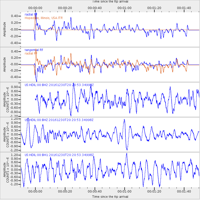
Signal To Noise
| Channel | StoN | STA | LTA |
| US:HDIL:00:BHZ:20161230T20:20:53.34998Z | 1.3083072 | 4.6319997E-7 | 3.5404526E-7 |
| US:HDIL:00:BH1:20161230T20:20:53.34998Z | 0.8642269 | 4.704078E-7 | 5.443105E-7 |
| US:HDIL:00:BH2:20161230T20:20:53.34998Z | 1.3109035 | 4.961148E-7 | 3.7845257E-7 |
| Arrivals |
| Ps | |
| PpPs | |
| PsPs/PpSs | |


