You are here: Home > Network List > TA - USArray Transportable Network (new EarthScope stations) Stations List
> Station H31M Peel River, Yukon, CAN > Earthquake Result Viewer
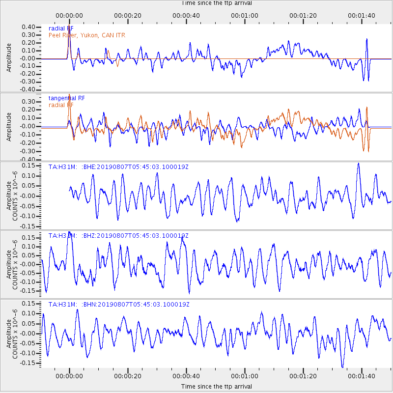
H31M Peel River, Yukon, CAN - Earthquake Result Viewer
*The percent match for this event was below the threshold and hence no stack was calculated.
| Earthquake location: |
Vanuatu Islands |
| Earthquake latitude/longitude: |
-15.5/167.7 |
| Earthquake time(UTC): |
2019/08/07 (219) 05:32:40 GMT |
| Earthquake Depth: |
123 km |
| Earthquake Magnitude: |
5.8 Mww |
| Earthquake Catalog/Contributor: |
NEIC PDE/us |
|
| Network: |
TA USArray Transportable Network (new EarthScope stations) |
| Station: |
H31M Peel River, Yukon, CAN |
| Lat/Lon: |
65.81 N/134.34 W |
| Elevation: |
642 m |
|
| Distance: |
91.8 deg |
| Az: |
20.457 deg |
| Baz: |
234.839 deg |
| Ray Param: |
$rayparam |
*The percent match for this event was below the threshold and hence was not used in the summary stack. |
|
| Radial Match: |
42.721333 % |
| Radial Bump: |
400 |
| Transverse Match: |
57.137676 % |
| Transverse Bump: |
400 |
| SOD ConfigId: |
19053131 |
| Insert Time: |
2019-08-21 05:39:40.617 +0000 |
| GWidth: |
2.5 |
| Max Bumps: |
400 |
| Tol: |
0.001 |
|
Signal To Noise
| Channel | StoN | STA | LTA |
| TA:H31M: :BHZ:20190807T05:45:03.100019Z | 1.7301517 | 1.0352633E-7 | 5.9836566E-8 |
| TA:H31M: :BHN:20190807T05:45:03.100019Z | 1.1833733 | 5.979514E-8 | 5.05294E-8 |
| TA:H31M: :BHE:20190807T05:45:03.100019Z | 1.3851163 | 6.791485E-8 | 4.9031872E-8 |
| Arrivals |
| Ps | |
| PpPs | |
| PsPs/PpSs | |


