You are here: Home > Network List > TA - USArray Transportable Network (new EarthScope stations) Stations List
> Station M16K Timber Creek, AK, USA > Earthquake Result Viewer
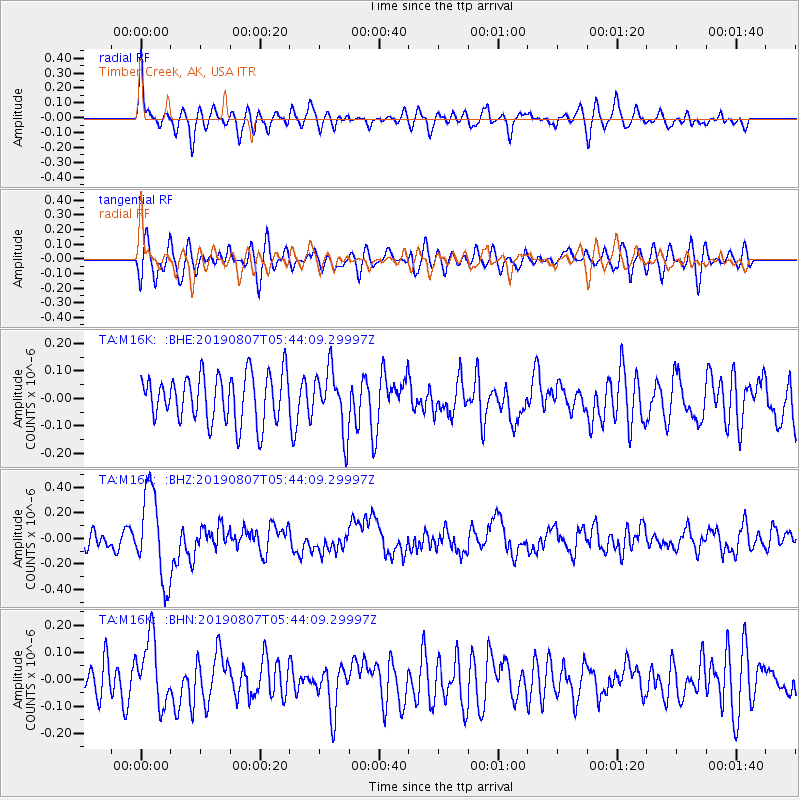
M16K Timber Creek, AK, USA - Earthquake Result Viewer
*The percent match for this event was below the threshold and hence no stack was calculated.
| Earthquake location: |
Vanuatu Islands |
| Earthquake latitude/longitude: |
-15.5/167.7 |
| Earthquake time(UTC): |
2019/08/07 (219) 05:32:40 GMT |
| Earthquake Depth: |
123 km |
| Earthquake Magnitude: |
5.8 Mww |
| Earthquake Catalog/Contributor: |
NEIC PDE/us |
|
| Network: |
TA USArray Transportable Network (new EarthScope stations) |
| Station: |
M16K Timber Creek, AK, USA |
| Lat/Lon: |
61.02 N/158.96 W |
| Elevation: |
394 m |
|
| Distance: |
80.8 deg |
| Az: |
15.73 deg |
| Baz: |
212.46 deg |
| Ray Param: |
$rayparam |
*The percent match for this event was below the threshold and hence was not used in the summary stack. |
|
| Radial Match: |
68.0633 % |
| Radial Bump: |
400 |
| Transverse Match: |
57.888607 % |
| Transverse Bump: |
400 |
| SOD ConfigId: |
19053131 |
| Insert Time: |
2019-08-21 05:39:59.759 +0000 |
| GWidth: |
2.5 |
| Max Bumps: |
400 |
| Tol: |
0.001 |
|
Signal To Noise
| Channel | StoN | STA | LTA |
| TA:M16K: :BHZ:20190807T05:44:09.29997Z | 5.6829247 | 3.4770207E-7 | 6.118365E-8 |
| TA:M16K: :BHN:20190807T05:44:09.29997Z | 1.8197664 | 1.2422733E-7 | 6.826554E-8 |
| TA:M16K: :BHE:20190807T05:44:09.29997Z | 1.2807934 | 1.1088367E-7 | 8.65742E-8 |
| Arrivals |
| Ps | |
| PpPs | |
| PsPs/PpSs | |


