You are here: Home > Network List > TA - USArray Transportable Network (new EarthScope stations) Stations List
> Station R33M Jennings River, BC, CAN > Earthquake Result Viewer
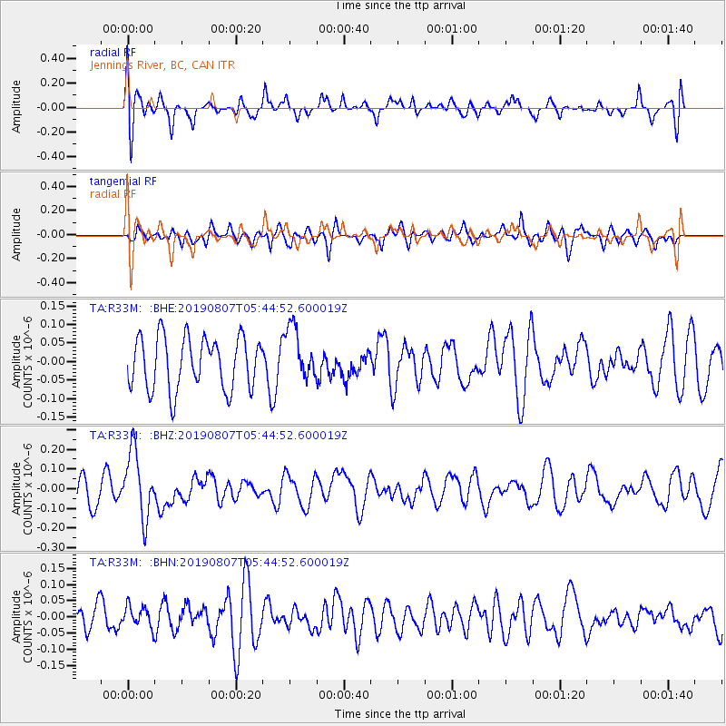
R33M Jennings River, BC, CAN - Earthquake Result Viewer
*The percent match for this event was below the threshold and hence no stack was calculated.
| Earthquake location: |
Vanuatu Islands |
| Earthquake latitude/longitude: |
-15.5/167.7 |
| Earthquake time(UTC): |
2019/08/07 (219) 05:32:40 GMT |
| Earthquake Depth: |
123 km |
| Earthquake Magnitude: |
5.8 Mww |
| Earthquake Catalog/Contributor: |
NEIC PDE/us |
|
| Network: |
TA USArray Transportable Network (new EarthScope stations) |
| Station: |
R33M Jennings River, BC, CAN |
| Lat/Lon: |
59.39 N/130.97 W |
| Elevation: |
1437 m |
|
| Distance: |
89.5 deg |
| Az: |
26.675 deg |
| Baz: |
237.765 deg |
| Ray Param: |
$rayparam |
*The percent match for this event was below the threshold and hence was not used in the summary stack. |
|
| Radial Match: |
53.41774 % |
| Radial Bump: |
400 |
| Transverse Match: |
54.329655 % |
| Transverse Bump: |
400 |
| SOD ConfigId: |
19053131 |
| Insert Time: |
2019-08-21 05:40:21.219 +0000 |
| GWidth: |
2.5 |
| Max Bumps: |
400 |
| Tol: |
0.001 |
|
Signal To Noise
| Channel | StoN | STA | LTA |
| TA:R33M: :BHZ:20190807T05:44:52.600019Z | 2.7262254 | 1.6990437E-7 | 6.23222E-8 |
| TA:R33M: :BHN:20190807T05:44:52.600019Z | 0.7286348 | 3.2773062E-8 | 4.4978723E-8 |
| TA:R33M: :BHE:20190807T05:44:52.600019Z | 1.0011631 | 7.06722E-8 | 7.059009E-8 |
| Arrivals |
| Ps | |
| PpPs | |
| PsPs/PpSs | |


