You are here: Home > Network List > US - United States National Seismic Network Stations List
> Station HAWA Hanford, Washington, USA > Earthquake Result Viewer
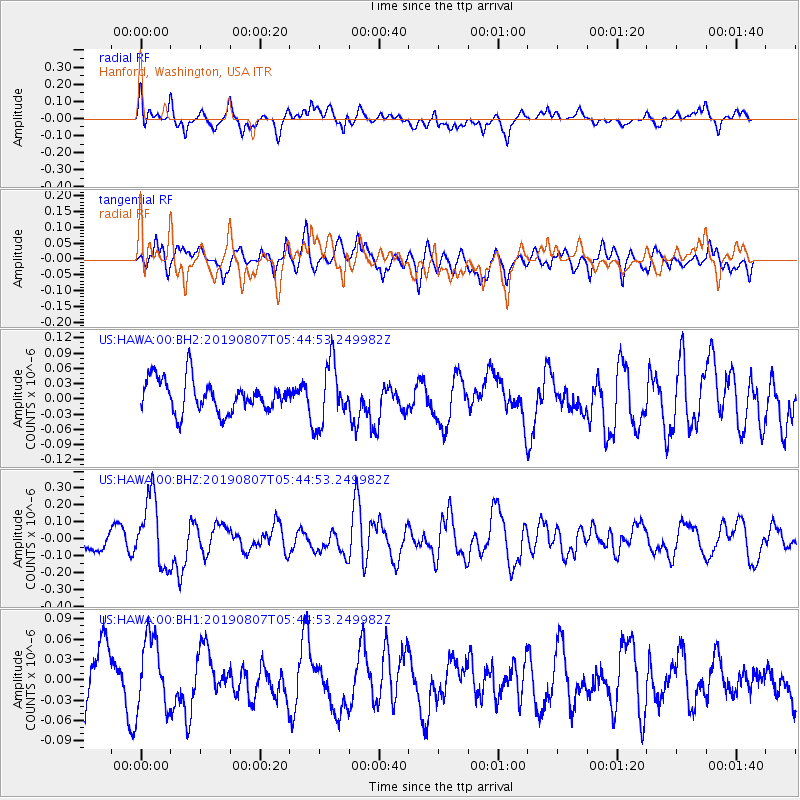
HAWA Hanford, Washington, USA - Earthquake Result Viewer
*The percent match for this event was below the threshold and hence no stack was calculated.
| Earthquake location: |
Vanuatu Islands |
| Earthquake latitude/longitude: |
-15.5/167.7 |
| Earthquake time(UTC): |
2019/08/07 (219) 05:32:40 GMT |
| Earthquake Depth: |
123 km |
| Earthquake Magnitude: |
5.8 Mww |
| Earthquake Catalog/Contributor: |
NEIC PDE/us |
|
| Network: |
US United States National Seismic Network |
| Station: |
HAWA Hanford, Washington, USA |
| Lat/Lon: |
46.39 N/119.53 W |
| Elevation: |
364 m |
|
| Distance: |
89.7 deg |
| Az: |
41.381 deg |
| Baz: |
247.038 deg |
| Ray Param: |
$rayparam |
*The percent match for this event was below the threshold and hence was not used in the summary stack. |
|
| Radial Match: |
70.866455 % |
| Radial Bump: |
400 |
| Transverse Match: |
53.42314 % |
| Transverse Bump: |
400 |
| SOD ConfigId: |
19053131 |
| Insert Time: |
2019-08-21 05:40:54.300 +0000 |
| GWidth: |
2.5 |
| Max Bumps: |
400 |
| Tol: |
0.001 |
|
Signal To Noise
| Channel | StoN | STA | LTA |
| US:HAWA:00:BHZ:20190807T05:44:53.249982Z | 3.2618377 | 2.0328497E-7 | 6.232222E-8 |
| US:HAWA:00:BH1:20190807T05:44:53.249982Z | 1.4135162 | 5.3211707E-8 | 3.7644924E-8 |
| US:HAWA:00:BH2:20190807T05:44:53.249982Z | 1.8773708 | 5.9703915E-8 | 3.1801875E-8 |
| Arrivals |
| Ps | |
| PpPs | |
| PsPs/PpSs | |


