You are here: Home > Network List > GS - US Geological Survey Networks Stations List
> Station DEC05 Decatur Surface Seismic Site, Decatur, IL, USA > Earthquake Result Viewer
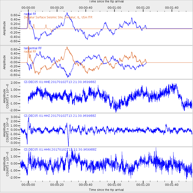
DEC05 Decatur Surface Seismic Site, Decatur, IL, USA - Earthquake Result Viewer
*The percent match for this event was below the threshold and hence no stack was calculated.
| Earthquake location: |
Northern Peru |
| Earthquake latitude/longitude: |
-4.9/-76.3 |
| Earthquake time(UTC): |
2017/01/02 (002) 13:13:48 GMT |
| Earthquake Depth: |
108 km |
| Earthquake Magnitude: |
5.9 Mwb |
| Earthquake Catalog/Contributor: |
NEIC PDE/us |
|
| Network: |
GS US Geological Survey Networks |
| Station: |
DEC05 Decatur Surface Seismic Site, Decatur, IL, USA |
| Lat/Lon: |
39.87 N/88.87 W |
| Elevation: |
216 m |
|
| Distance: |
46.0 deg |
| Az: |
346.585 deg |
| Baz: |
162.521 deg |
| Ray Param: |
$rayparam |
*The percent match for this event was below the threshold and hence was not used in the summary stack. |
|
| Radial Match: |
40.662926 % |
| Radial Bump: |
400 |
| Transverse Match: |
30.018421 % |
| Transverse Bump: |
400 |
| SOD ConfigId: |
1943534 |
| Insert Time: |
2017-01-16 13:15:08.112 +0000 |
| GWidth: |
2.5 |
| Max Bumps: |
400 |
| Tol: |
0.001 |
|
Signal To Noise
| Channel | StoN | STA | LTA |
| GS:DEC05:01:HHZ:20170102T13:21:30.969988Z | 5.8606353 | 1.2408221E-6 | 2.1172144E-7 |
| GS:DEC05:01:HHN:20170102T13:21:30.969988Z | 1.8266815 | 8.6583555E-7 | 4.739937E-7 |
| GS:DEC05:01:HHE:20170102T13:21:30.969988Z | 1.3767186 | 6.193944E-7 | 4.4990634E-7 |
| Arrivals |
| Ps | |
| PpPs | |
| PsPs/PpSs | |


