You are here: Home > Network List > TA - USArray Transportable Network (new EarthScope stations) Stations List
> Station B18K Kokolik River, AK, USA > Earthquake Result Viewer
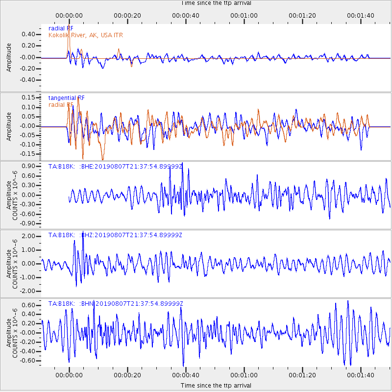
B18K Kokolik River, AK, USA - Earthquake Result Viewer
*The percent match for this event was below the threshold and hence no stack was calculated.
| Earthquake location: |
Taiwan |
| Earthquake latitude/longitude: |
24.5/121.9 |
| Earthquake time(UTC): |
2019/08/07 (219) 21:28:02 GMT |
| Earthquake Depth: |
10 km |
| Earthquake Magnitude: |
5.9 Mww |
| Earthquake Catalog/Contributor: |
NEIC PDE/us |
|
| Network: |
TA USArray Transportable Network (new EarthScope stations) |
| Station: |
B18K Kokolik River, AK, USA |
| Lat/Lon: |
69.36 N/161.80 W |
| Elevation: |
222 m |
|
| Distance: |
62.5 deg |
| Az: |
22.847 deg |
| Baz: |
266.351 deg |
| Ray Param: |
$rayparam |
*The percent match for this event was below the threshold and hence was not used in the summary stack. |
|
| Radial Match: |
63.23578 % |
| Radial Bump: |
400 |
| Transverse Match: |
62.17511 % |
| Transverse Bump: |
400 |
| SOD ConfigId: |
19053131 |
| Insert Time: |
2019-08-21 21:34:07.304 +0000 |
| GWidth: |
2.5 |
| Max Bumps: |
400 |
| Tol: |
0.001 |
|
Signal To Noise
| Channel | StoN | STA | LTA |
| TA:B18K: :BHZ:20190807T21:37:54.89999Z | 4.308809 | 9.441731E-7 | 2.1912625E-7 |
| TA:B18K: :BHN:20190807T21:37:54.89999Z | 1.9809048 | 3.0930508E-7 | 1.5614334E-7 |
| TA:B18K: :BHE:20190807T21:37:54.89999Z | 2.0362003 | 3.0699184E-7 | 1.5076702E-7 |
| Arrivals |
| Ps | |
| PpPs | |
| PsPs/PpSs | |


