You are here: Home > Network List > TA - USArray Transportable Network (new EarthScope stations) Stations List
> Station A09A Danville, WA, USA > Earthquake Result Viewer
A09A Danville, WA, USA - Earthquake Result Viewer

| Earthquake location: |
Kuril Islands |
| Earthquake latitude/longitude: |
46.5/153.2 |
| Earthquake time(UTC): |
2006/10/01 (274) 09:06:02 GMT |
| Earthquake Depth: |
19 km |
| Earthquake Magnitude: |
6.1 MB, 6.4 MS, 6.6 MW, 6.5 MW |
| Earthquake Catalog/Contributor: |
WHDF/NEIC |
|
| Network: |
TA USArray Transportable Network (new EarthScope stations) |
| Station: |
A09A Danville, WA, USA |
| Lat/Lon: |
48.98 N/118.59 W |
| Elevation: |
931 m |
|
| Distance: |
56.1 deg |
| Az: |
52.532 deg |
| Baz: |
303.637 deg |
| Ray Param: |
0.06435878 |
| Estimated Moho Depth: |
34.75 km |
| Estimated Crust Vp/Vs: |
1.70 |
| Assumed Crust Vp: |
6.419 km/s |
| Estimated Crust Vs: |
3.776 km/s |
| Estimated Crust Poisson's Ratio: |
0.24 |
|
| Radial Match: |
94.84102 % |
| Radial Bump: |
350 |
| Transverse Match: |
74.62433 % |
| Transverse Bump: |
400 |
| SOD ConfigId: |
2665 |
| Insert Time: |
2010-03-07 03:02:40.161 +0000 |
| GWidth: |
2.5 |
| Max Bumps: |
400 |
| Tol: |
0.001 |
|
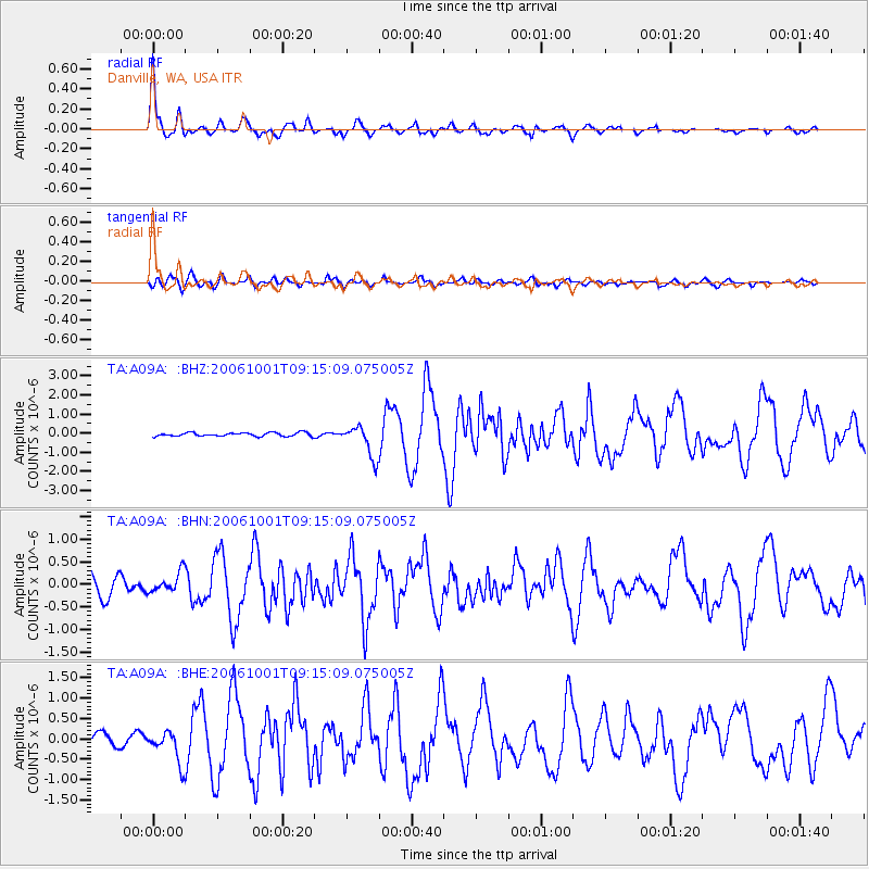
Signal To Noise
| Channel | StoN | STA | LTA |
| TA:A09A: :BHN:20061001T09:15:09.075005Z | 1.0216296 | 2.2130914E-7 | 2.1662366E-7 |
| TA:A09A: :BHE:20061001T09:15:09.075005Z | 3.370623 | 3.8923932E-7 | 1.1547993E-7 |
| TA:A09A: :BHZ:20061001T09:15:09.075005Z | 8.91476 | 8.3316405E-7 | 9.345895E-8 |
| Arrivals |
| Ps | 4.0 SECOND |
| PpPs | 14 SECOND |
| PsPs/PpSs | 18 SECOND |


