You are here: Home > Network List > TA - USArray Transportable Network (new EarthScope stations) Stations List
> Station A09A Danville, WA, USA > Earthquake Result Viewer
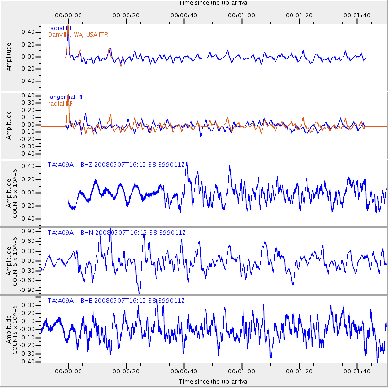
A09A Danville, WA, USA - Earthquake Result Viewer
*The percent match for this event was below the threshold and hence no stack was calculated.
| Earthquake location: |
Near East Coast Of Honshu, Japan |
| Earthquake latitude/longitude: |
36.2/141.5 |
| Earthquake time(UTC): |
2008/05/07 (128) 16:02:02 GMT |
| Earthquake Depth: |
19 km |
| Earthquake Magnitude: |
5.7 MB, 6.2 MW, 6.2 MW |
| Earthquake Catalog/Contributor: |
WHDF/NEIC |
|
| Network: |
TA USArray Transportable Network (new EarthScope stations) |
| Station: |
A09A Danville, WA, USA |
| Lat/Lon: |
48.98 N/118.59 W |
| Elevation: |
931 m |
|
| Distance: |
69.5 deg |
| Az: |
43.882 deg |
| Baz: |
301.662 deg |
| Ray Param: |
$rayparam |
*The percent match for this event was below the threshold and hence was not used in the summary stack. |
|
| Radial Match: |
74.4687 % |
| Radial Bump: |
400 |
| Transverse Match: |
57.01861 % |
| Transverse Bump: |
400 |
| SOD ConfigId: |
2504 |
| Insert Time: |
2010-03-07 03:02:58.246 +0000 |
| GWidth: |
2.5 |
| Max Bumps: |
400 |
| Tol: |
0.001 |
|
Signal To Noise
| Channel | StoN | STA | LTA |
| TA:A09A: :BHN:20080507T16:12:38.399011Z | 2.008292 | 2.1328E-7 | 1.0619969E-7 |
| TA:A09A: :BHE:20080507T16:12:38.399011Z | 1.1382436 | 9.438758E-8 | 8.292389E-8 |
| TA:A09A: :BHZ:20080507T16:12:38.399011Z | 0.8438998 | 8.977504E-8 | 1.06381165E-7 |
| Arrivals |
| Ps | |
| PpPs | |
| PsPs/PpSs | |


