You are here: Home > Network List > TA - USArray Transportable Network (new EarthScope stations) Stations List
> Station A09A Danville, WA, USA > Earthquake Result Viewer
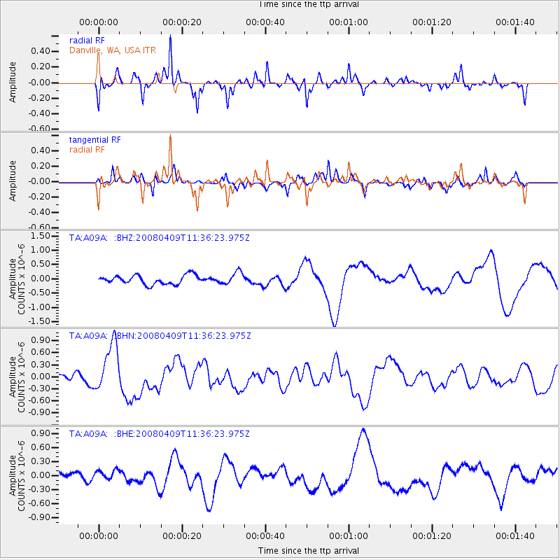
A09A Danville, WA, USA - Earthquake Result Viewer
*The percent match for this event was below the threshold and hence no stack was calculated.
| Earthquake location: |
Loyalty Islands |
| Earthquake latitude/longitude: |
-20.2/168.9 |
| Earthquake time(UTC): |
2008/04/09 (100) 11:23:40 GMT |
| Earthquake Depth: |
35 km |
| Earthquake Magnitude: |
5.7 MB, 6.3 MW, 6.3 MW |
| Earthquake Catalog/Contributor: |
WHDF/NEIC |
|
| Network: |
TA USArray Transportable Network (new EarthScope stations) |
| Station: |
A09A Danville, WA, USA |
| Lat/Lon: |
48.98 N/118.59 W |
| Elevation: |
931 m |
|
| Distance: |
94.1 deg |
| Az: |
39.055 deg |
| Baz: |
243.927 deg |
| Ray Param: |
$rayparam |
*The percent match for this event was below the threshold and hence was not used in the summary stack. |
|
| Radial Match: |
54.370964 % |
| Radial Bump: |
284 |
| Transverse Match: |
61.926147 % |
| Transverse Bump: |
377 |
| SOD ConfigId: |
2504 |
| Insert Time: |
2010-03-07 03:03:03.445 +0000 |
| GWidth: |
2.5 |
| Max Bumps: |
400 |
| Tol: |
0.001 |
|
Signal To Noise
| Channel | StoN | STA | LTA |
| TA:A09A: :BHN:20080409T11:36:23.975Z | 6.1516833 | 6.197646E-7 | 1.0074715E-7 |
| TA:A09A: :BHE:20080409T11:36:23.975Z | 1.4032502 | 1.09988044E-7 | 7.838092E-8 |
| TA:A09A: :BHZ:20080409T11:36:23.975Z | 1.415469 | 2.2092898E-7 | 1.5608182E-7 |
| Arrivals |
| Ps | |
| PpPs | |
| PsPs/PpSs | |


