You are here: Home > Network List > TA - USArray Transportable Network (new EarthScope stations) Stations List
> Station A09A Danville, WA, USA > Earthquake Result Viewer
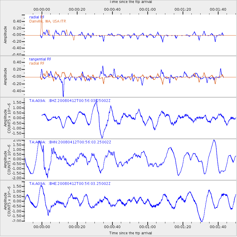
A09A Danville, WA, USA - Earthquake Result Viewer
*The percent match for this event was below the threshold and hence no stack was calculated.
| Earthquake location: |
Kuril Islands |
| Earthquake latitude/longitude: |
43.9/147.5 |
| Earthquake time(UTC): |
2008/04/12 (103) 00:46:28 GMT |
| Earthquake Depth: |
64 km |
| Earthquake Magnitude: |
5.7 MB |
| Earthquake Catalog/Contributor: |
WHDF/NEIC |
|
| Network: |
TA USArray Transportable Network (new EarthScope stations) |
| Station: |
A09A Danville, WA, USA |
| Lat/Lon: |
48.98 N/118.59 W |
| Elevation: |
931 m |
|
| Distance: |
60.9 deg |
| Az: |
48.822 deg |
| Baz: |
304.306 deg |
| Ray Param: |
$rayparam |
*The percent match for this event was below the threshold and hence was not used in the summary stack. |
|
| Radial Match: |
61.163704 % |
| Radial Bump: |
400 |
| Transverse Match: |
44.980015 % |
| Transverse Bump: |
342 |
| SOD ConfigId: |
2504 |
| Insert Time: |
2010-03-07 03:03:07.443 +0000 |
| GWidth: |
2.5 |
| Max Bumps: |
400 |
| Tol: |
0.001 |
|
Signal To Noise
| Channel | StoN | STA | LTA |
| TA:A09A: :BHN:20080412T00:56:03.25002Z | 1.9296817 | 1.2464203E-6 | 6.459201E-7 |
| TA:A09A: :BHE:20080412T00:56:03.25002Z | 4.452694 | 1.0977677E-6 | 2.4654014E-7 |
| TA:A09A: :BHZ:20080412T00:56:03.25002Z | 3.6915343 | 1.3355038E-6 | 3.6177474E-7 |
| Arrivals |
| Ps | |
| PpPs | |
| PsPs/PpSs | |


