
B11A Sanpoint, ID, USA - Earthquake Result Viewer
| ||||||||||||||||||
| ||||||||||||||||||
| ||||||||||||||||||
|
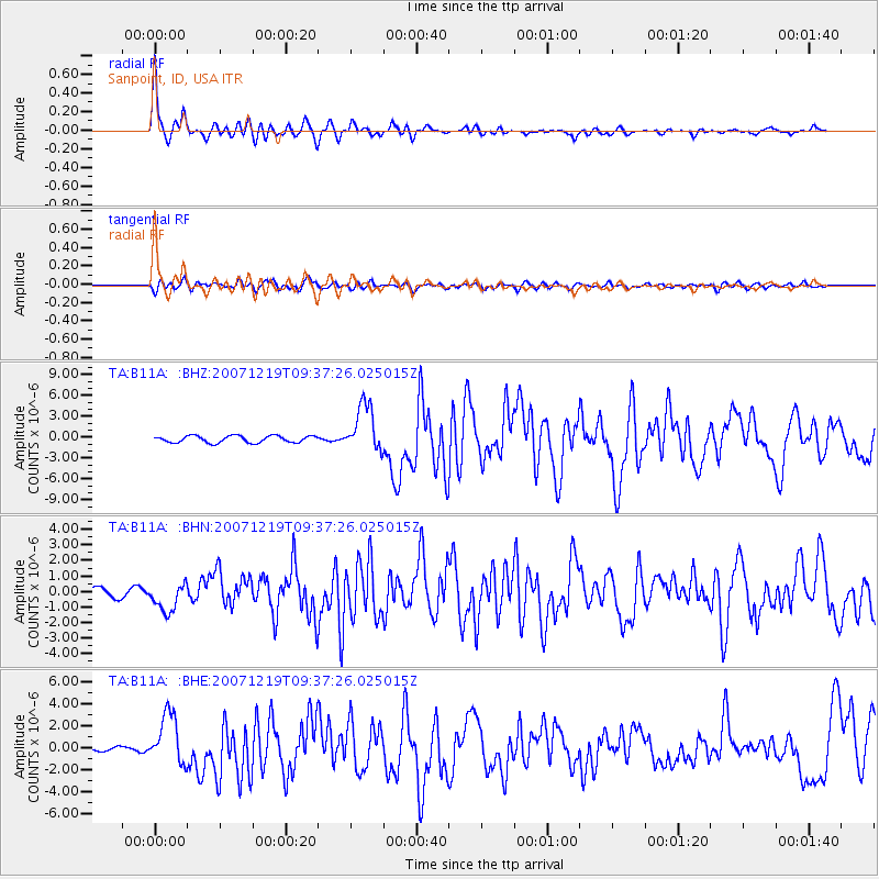
Signal To Noise
| Channel | StoN | STA | LTA |
| TA:B11A: :BHN:20071219T09:37:26.025015Z | 3.0317106 | 9.2625805E-7 | 3.0552326E-7 |
| TA:B11A: :BHE:20071219T09:37:26.025015Z | 6.062755 | 2.2867305E-6 | 3.771768E-7 |
| TA:B11A: :BHZ:20071219T09:37:26.025015Z | 7.0412483 | 3.4360544E-6 | 4.879894E-7 |
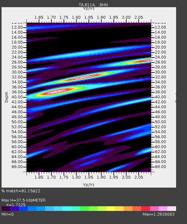
| Arrivals | |
| Ps | 4.5 SECOND |
| PpPs | 14 SECOND |
| PsPs/PpSs | 19 SECOND |

