
B11A Sanpoint, ID, USA - Earthquake Result Viewer
| ||||||||||||||||||
| ||||||||||||||||||
| ||||||||||||||||||
|
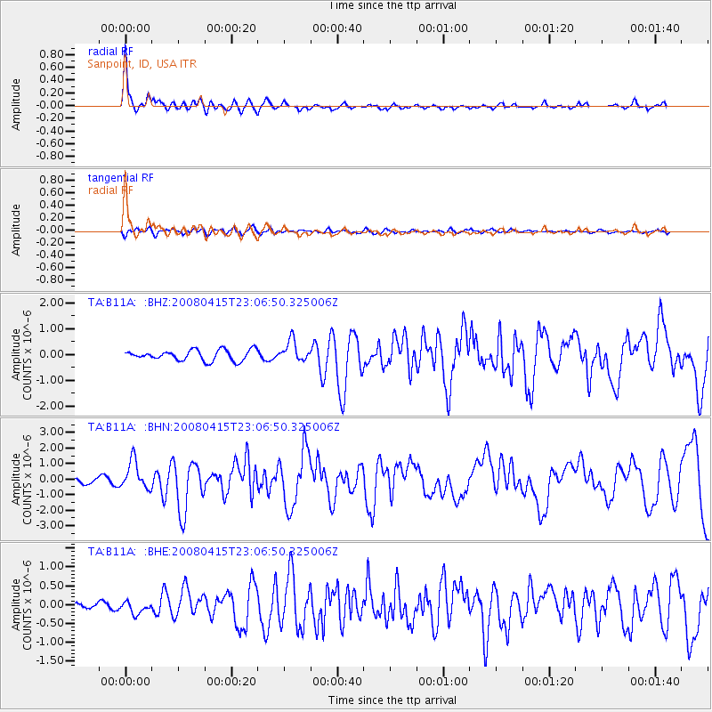
Signal To Noise
| Channel | StoN | STA | LTA |
| TA:B11A: :BHN:20080415T23:06:50.325006Z | 6.0607505 | 9.196446E-7 | 1.5173775E-7 |
| TA:B11A: :BHE:20080415T23:06:50.325006Z | 2.4747734 | 1.6676518E-7 | 6.738604E-8 |
| TA:B11A: :BHZ:20080415T23:06:50.325006Z | 2.0036035 | 4.068252E-7 | 2.0304677E-7 |
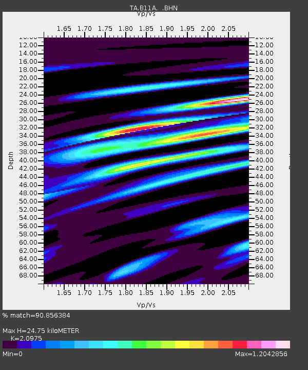
| Arrivals | |
| Ps | 4.4 SECOND |
| PpPs | 11 SECOND |
| PsPs/PpSs | 15 SECOND |

