You are here: Home > Network List > TA - USArray Transportable Network (new EarthScope stations) Stations List
> Station B11A Sanpoint, ID, USA > Earthquake Result Viewer
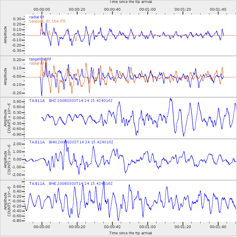
B11A Sanpoint, ID, USA - Earthquake Result Viewer
*The percent match for this event was below the threshold and hence no stack was calculated.
| Earthquake location: |
Philippine Islands Region |
| Earthquake latitude/longitude: |
13.4/125.6 |
| Earthquake time(UTC): |
2008/03/03 (063) 14:11:14 GMT |
| Earthquake Depth: |
24 km |
| Earthquake Magnitude: |
6.4 MB, 6.9 MW, 6.8 MW |
| Earthquake Catalog/Contributor: |
WHDF/NEIC |
|
| Network: |
TA USArray Transportable Network (new EarthScope stations) |
| Station: |
B11A Sanpoint, ID, USA |
| Lat/Lon: |
48.44 N/116.37 W |
| Elevation: |
870 m |
|
| Distance: |
97.7 deg |
| Az: |
36.389 deg |
| Baz: |
299.878 deg |
| Ray Param: |
$rayparam |
*The percent match for this event was below the threshold and hence was not used in the summary stack. |
|
| Radial Match: |
72.804535 % |
| Radial Bump: |
400 |
| Transverse Match: |
62.664967 % |
| Transverse Bump: |
400 |
| SOD ConfigId: |
2504 |
| Insert Time: |
2010-03-07 03:04:33.636 +0000 |
| GWidth: |
2.5 |
| Max Bumps: |
400 |
| Tol: |
0.001 |
|
Signal To Noise
| Channel | StoN | STA | LTA |
| TA:B11A: :BHN:20080303T14:24:15.424016Z | 3.5837677 | 5.1482573E-7 | 1.4365487E-7 |
| TA:B11A: :BHE:20080303T14:24:15.424016Z | 1.1400619 | 1.6941986E-7 | 1.4860584E-7 |
| TA:B11A: :BHZ:20080303T14:24:15.424016Z | 1.0881053 | 1.801958E-7 | 1.656051E-7 |
| Arrivals |
| Ps | |
| PpPs | |
| PsPs/PpSs | |


