You are here: Home > Network List > TA - USArray Transportable Network (new EarthScope stations) Stations List
> Station B11A Sanpoint, ID, USA > Earthquake Result Viewer
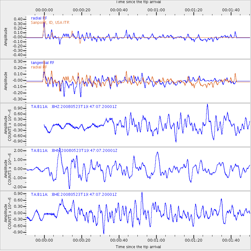
B11A Sanpoint, ID, USA - Earthquake Result Viewer
*The percent match for this event was below the threshold and hence no stack was calculated.
| Earthquake location: |
Central Mid-Atlantic Ridge |
| Earthquake latitude/longitude: |
7.3/-34.9 |
| Earthquake time(UTC): |
2008/05/23 (144) 19:35:34 GMT |
| Earthquake Depth: |
9.0 km |
| Earthquake Magnitude: |
6.0 MB, 6.4 MS, 6.5 MW, 6.5 MW |
| Earthquake Catalog/Contributor: |
WHDF/NEIC |
|
| Network: |
TA USArray Transportable Network (new EarthScope stations) |
| Station: |
B11A Sanpoint, ID, USA |
| Lat/Lon: |
48.44 N/116.37 W |
| Elevation: |
870 m |
|
| Distance: |
78.9 deg |
| Az: |
317.848 deg |
| Baz: |
91.492 deg |
| Ray Param: |
$rayparam |
*The percent match for this event was below the threshold and hence was not used in the summary stack. |
|
| Radial Match: |
76.624794 % |
| Radial Bump: |
400 |
| Transverse Match: |
65.88739 % |
| Transverse Bump: |
400 |
| SOD ConfigId: |
2504 |
| Insert Time: |
2010-03-07 03:04:44.337 +0000 |
| GWidth: |
2.5 |
| Max Bumps: |
400 |
| Tol: |
0.001 |
|
Signal To Noise
| Channel | StoN | STA | LTA |
| TA:B11A: :BHN:20080523T19:47:07.20001Z | 2.2072234 | 4.5588712E-7 | 2.0654326E-7 |
| TA:B11A: :BHE:20080523T19:47:07.20001Z | 0.42500153 | 7.167554E-8 | 1.6864772E-7 |
| TA:B11A: :BHZ:20080523T19:47:07.20001Z | 2.0024743 | 2.4032866E-7 | 1.2001586E-7 |
| Arrivals |
| Ps | |
| PpPs | |
| PsPs/PpSs | |


