You are here: Home > Network List > US - United States National Seismic Network Stations List
> Station DGMT Dagmar, Montana, USA > Earthquake Result Viewer
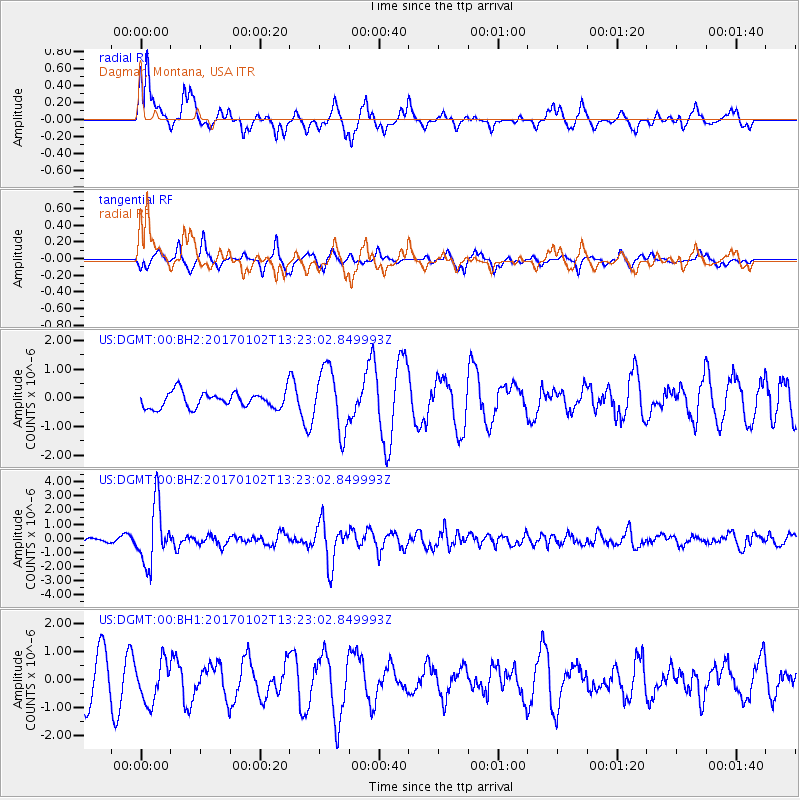
DGMT Dagmar, Montana, USA - Earthquake Result Viewer
*The percent match for this event was below the threshold and hence no stack was calculated.
| Earthquake location: |
Northern Peru |
| Earthquake latitude/longitude: |
-4.9/-76.3 |
| Earthquake time(UTC): |
2017/01/02 (002) 13:13:48 GMT |
| Earthquake Depth: |
108 km |
| Earthquake Magnitude: |
5.9 Mwb |
| Earthquake Catalog/Contributor: |
NEIC PDE/us |
|
| Network: |
US United States National Seismic Network |
| Station: |
DGMT Dagmar, Montana, USA |
| Lat/Lon: |
48.47 N/104.20 W |
| Elevation: |
0.0 m |
|
| Distance: |
58.5 deg |
| Az: |
338.602 deg |
| Baz: |
146.89 deg |
| Ray Param: |
$rayparam |
*The percent match for this event was below the threshold and hence was not used in the summary stack. |
|
| Radial Match: |
73.99243 % |
| Radial Bump: |
400 |
| Transverse Match: |
65.37924 % |
| Transverse Bump: |
326 |
| SOD ConfigId: |
1943534 |
| Insert Time: |
2017-01-16 13:18:17.101 +0000 |
| GWidth: |
2.5 |
| Max Bumps: |
400 |
| Tol: |
0.001 |
|
Signal To Noise
| Channel | StoN | STA | LTA |
| US:DGMT:00:BHZ:20170102T13:23:02.849993Z | 14.01976 | 2.0967775E-6 | 1.4955873E-7 |
| US:DGMT:00:BH1:20170102T13:23:02.849993Z | 0.9727189 | 7.269124E-7 | 7.4729957E-7 |
| US:DGMT:00:BH2:20170102T13:23:02.849993Z | 3.8990989 | 1.0756856E-6 | 2.7588055E-7 |
| Arrivals |
| Ps | |
| PpPs | |
| PsPs/PpSs | |


