You are here: Home > Network List > TA - USArray Transportable Network (new EarthScope stations) Stations List
> Station C10A Spilker Farm, Colbert, WA, USA > Earthquake Result Viewer
C10A Spilker Farm, Colbert, WA, USA - Earthquake Result Viewer

| Earthquake location: |
South Of Panama |
| Earthquake latitude/longitude: |
4.6/-78.5 |
| Earthquake time(UTC): |
2007/03/18 (077) 02:11:05 GMT |
| Earthquake Depth: |
8.0 km |
| Earthquake Magnitude: |
6.4 MB, 5.7 MS, 6.2 MW, 6.1 MW |
| Earthquake Catalog/Contributor: |
WHDF/NEIC |
|
| Network: |
TA USArray Transportable Network (new EarthScope stations) |
| Station: |
C10A Spilker Farm, Colbert, WA, USA |
| Lat/Lon: |
47.82 N/117.31 W |
| Elevation: |
684 m |
|
| Distance: |
54.4 deg |
| Az: |
328.704 deg |
| Baz: |
129.794 deg |
| Ray Param: |
0.06547948 |
| Estimated Moho Depth: |
33.5 km |
| Estimated Crust Vp/Vs: |
1.94 |
| Assumed Crust Vp: |
6.571 km/s |
| Estimated Crust Vs: |
3.391 km/s |
| Estimated Crust Poisson's Ratio: |
0.32 |
|
| Radial Match: |
85.70394 % |
| Radial Bump: |
400 |
| Transverse Match: |
68.67921 % |
| Transverse Bump: |
400 |
| SOD ConfigId: |
2564 |
| Insert Time: |
2010-03-07 03:06:06.678 +0000 |
| GWidth: |
2.5 |
| Max Bumps: |
400 |
| Tol: |
0.001 |
|
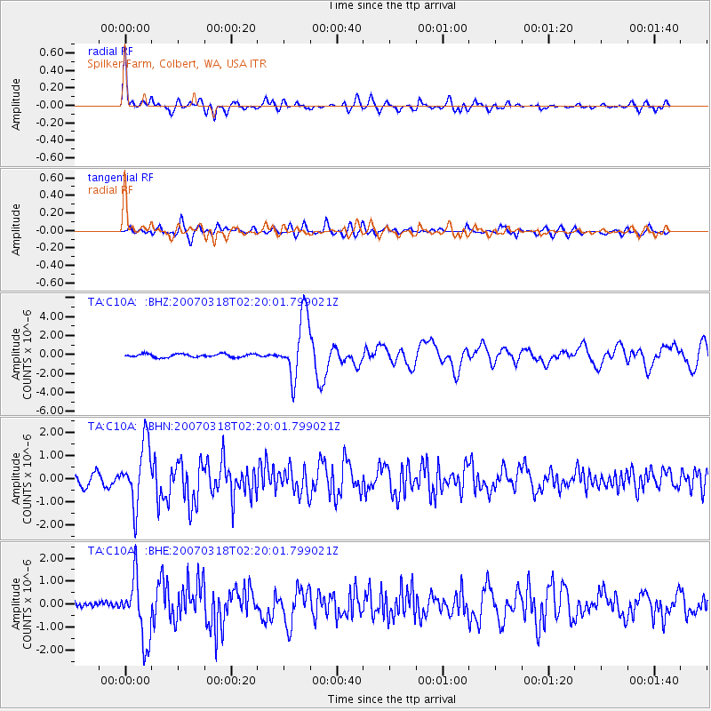
Signal To Noise
| Channel | StoN | STA | LTA |
| TA:C10A: :BHN:20070318T02:20:01.799021Z | 5.8529863 | 1.33272E-6 | 2.2769915E-7 |
| TA:C10A: :BHE:20070318T02:20:01.799021Z | 8.736939 | 1.3637689E-6 | 1.560923E-7 |
| TA:C10A: :BHZ:20070318T02:20:01.799021Z | 18.532587 | 3.319028E-6 | 1.7909146E-7 |
| Arrivals |
| Ps | 5.0 SECOND |
| PpPs | 14 SECOND |
| PsPs/PpSs | 19 SECOND |


