You are here: Home > Network List > TA - USArray Transportable Network (new EarthScope stations) Stations List
> Station C10A Spilker Farm, Colbert, WA, USA > Earthquake Result Viewer
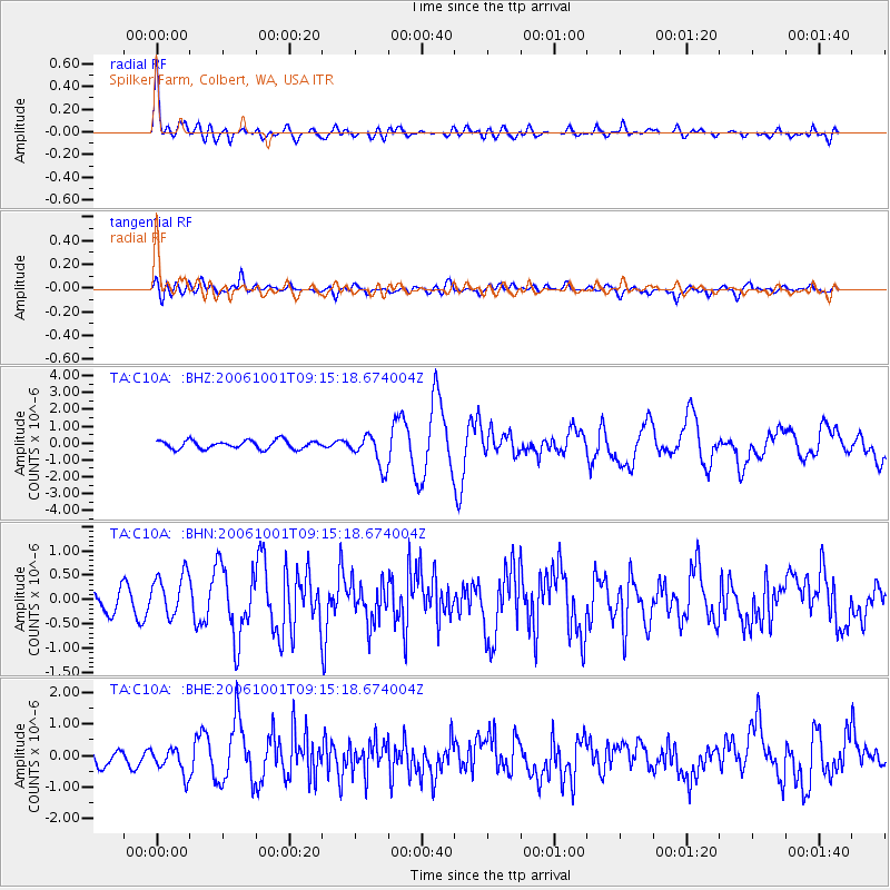
C10A Spilker Farm, Colbert, WA, USA - Earthquake Result Viewer

| Earthquake location: |
Kuril Islands |
| Earthquake latitude/longitude: |
46.5/153.2 |
| Earthquake time(UTC): |
2006/10/01 (274) 09:06:02 GMT |
| Earthquake Depth: |
19 km |
| Earthquake Magnitude: |
6.1 MB, 6.4 MS, 6.6 MW, 6.5 MW |
| Earthquake Catalog/Contributor: |
WHDF/NEIC |
|
| Network: |
TA USArray Transportable Network (new EarthScope stations) |
| Station: |
C10A Spilker Farm, Colbert, WA, USA |
| Lat/Lon: |
47.82 N/117.31 W |
| Elevation: |
684 m |
|
| Distance: |
57.4 deg |
| Az: |
53.102 deg |
| Baz: |
304.902 deg |
| Ray Param: |
0.063477 |
| Estimated Moho Depth: |
34.25 km |
| Estimated Crust Vp/Vs: |
1.63 |
| Assumed Crust Vp: |
6.571 km/s |
| Estimated Crust Vs: |
4.031 km/s |
| Estimated Crust Poisson's Ratio: |
0.20 |
|
| Radial Match: |
86.147385 % |
| Radial Bump: |
400 |
| Transverse Match: |
66.909615 % |
| Transverse Bump: |
400 |
| SOD ConfigId: |
2665 |
| Insert Time: |
2010-03-07 03:06:26.529 +0000 |
| GWidth: |
2.5 |
| Max Bumps: |
400 |
| Tol: |
0.001 |
|
Signal To Noise
| Channel | StoN | STA | LTA |
| TA:C10A: :BHN:20061001T09:15:18.674004Z | 1.6763155 | 4.3664986E-7 | 2.604819E-7 |
| TA:C10A: :BHE:20061001T09:15:18.674004Z | 1.245295 | 4.1401242E-7 | 3.324613E-7 |
| TA:C10A: :BHZ:20061001T09:15:18.674004Z | 3.8820486 | 9.608386E-7 | 2.4750813E-7 |
| Arrivals |
| Ps | 3.5 SECOND |
| PpPs | 13 SECOND |
| PsPs/PpSs | 16 SECOND |


