You are here: Home > Network List > TA - USArray Transportable Network (new EarthScope stations) Stations List
> Station L20K Farewell, AK, USA > Earthquake Result Viewer
L20K Farewell, AK, USA - Earthquake Result Viewer

| Earthquake location: |
Hindu Kush Region, Afghanistan |
| Earthquake latitude/longitude: |
36.5/70.0 |
| Earthquake time(UTC): |
2019/08/08 (220) 00:45:26 GMT |
| Earthquake Depth: |
222 km |
| Earthquake Magnitude: |
5.8 Mww |
| Earthquake Catalog/Contributor: |
NEIC PDE/us |
|
| Network: |
TA USArray Transportable Network (new EarthScope stations) |
| Station: |
L20K Farewell, AK, USA |
| Lat/Lon: |
62.48 N/153.88 W |
| Elevation: |
673 m |
|
| Distance: |
75.2 deg |
| Az: |
19.47 deg |
| Baz: |
324.702 deg |
| Ray Param: |
0.05123974 |
| Estimated Moho Depth: |
36.25 km |
| Estimated Crust Vp/Vs: |
1.86 |
| Assumed Crust Vp: |
6.566 km/s |
| Estimated Crust Vs: |
3.53 km/s |
| Estimated Crust Poisson's Ratio: |
0.30 |
|
| Radial Match: |
90.61069 % |
| Radial Bump: |
400 |
| Transverse Match: |
81.76759 % |
| Transverse Bump: |
400 |
| SOD ConfigId: |
19053131 |
| Insert Time: |
2019-08-22 00:55:47.934 +0000 |
| GWidth: |
2.5 |
| Max Bumps: |
400 |
| Tol: |
0.001 |
|
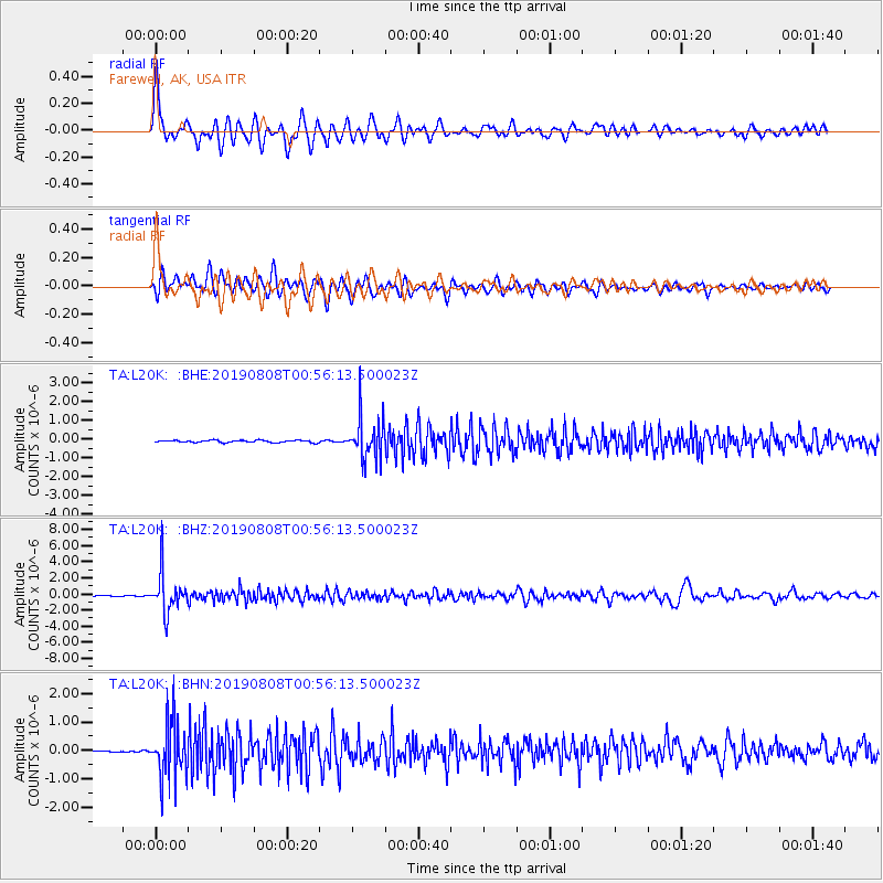
Signal To Noise
| Channel | StoN | STA | LTA |
| TA:L20K: :BHZ:20190808T00:56:13.500023Z | 26.8841 | 2.4479941E-6 | 9.105732E-8 |
| TA:L20K: :BHN:20190808T00:56:13.500023Z | 38.12468 | 9.883911E-7 | 2.592523E-8 |
| TA:L20K: :BHE:20190808T00:56:13.500023Z | 19.102083 | 1.1300266E-6 | 5.9157248E-8 |
| Arrivals |
| Ps | 4.9 SECOND |
| PpPs | 15 SECOND |
| PsPs/PpSs | 20 SECOND |


