
MLAC Mammoth Lakes, California, USA - Earthquake Result Viewer
| ||||||||||||||||||
| ||||||||||||||||||
| ||||||||||||||||||
|
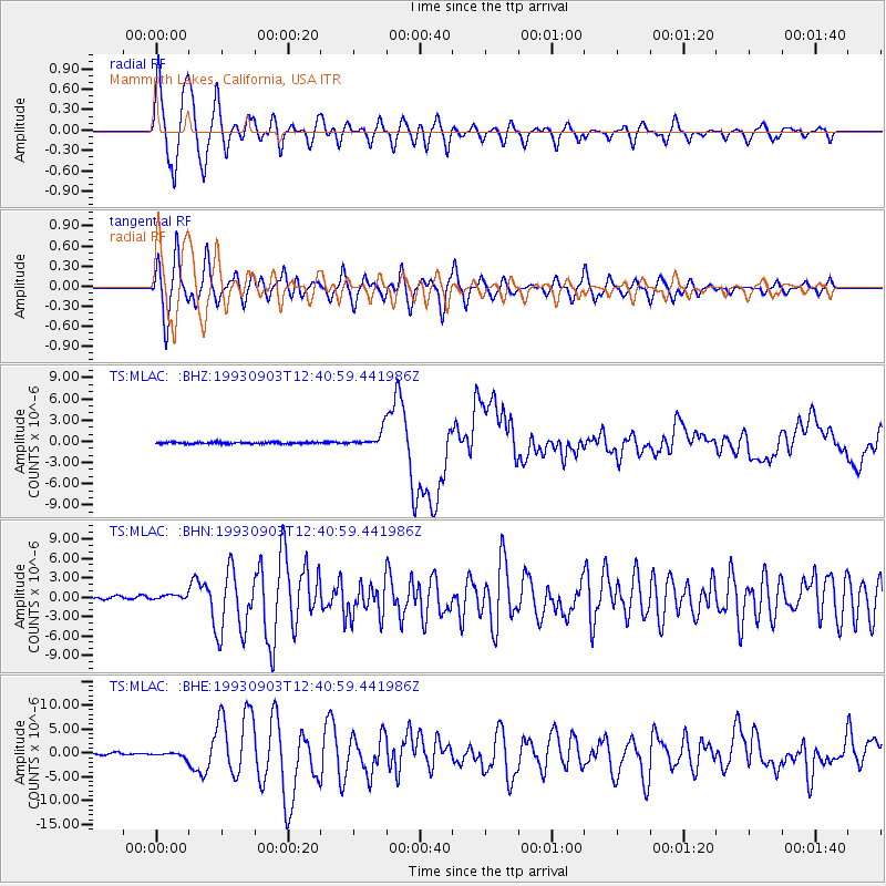
Signal To Noise
| Channel | StoN | STA | LTA |
| TS:MLAC: :BHN:19930903T12:40:59.441986Z | 1.9576842 | 5.051981E-7 | 2.5805906E-7 |
| TS:MLAC: :BHE:19930903T12:40:59.441986Z | 1.985146 | 5.4093556E-7 | 2.7249158E-7 |
| TS:MLAC: :BHZ:19930903T12:40:59.441986Z | 10.206444 | 1.1308458E-6 | 1.1079724E-7 |
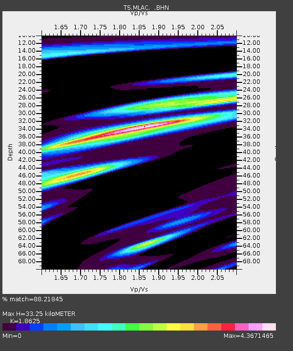
| Arrivals | |
| Ps | 4.9 SECOND |
| PpPs | 14 SECOND |
| PsPs/PpSs | 19 SECOND |

