You are here: Home > Network List > UU - University of Utah Regional Network Stations List
> Station FORU South Mineral Mountains, UT, USA > Earthquake Result Viewer
FORU South Mineral Mountains, UT, USA - Earthquake Result Viewer
*The percent match for this event was below the threshold and hence no stack was calculated.
| Earthquake location: |
Northern Peru |
| Earthquake latitude/longitude: |
-4.9/-76.3 |
| Earthquake time(UTC): |
2017/01/02 (002) 13:13:48 GMT |
| Earthquake Depth: |
108 km |
| Earthquake Magnitude: |
5.9 Mwb |
| Earthquake Catalog/Contributor: |
NEIC PDE/us |
|
| Network: |
UU University of Utah Regional Network |
| Station: |
FORU South Mineral Mountains, UT, USA |
| Lat/Lon: |
38.46 N/112.86 W |
| Elevation: |
1840 m |
|
| Distance: |
54.8 deg |
| Az: |
325.134 deg |
| Baz: |
133.486 deg |
| Ray Param: |
$rayparam |
*The percent match for this event was below the threshold and hence was not used in the summary stack. |
|
| Radial Match: |
64.87604 % |
| Radial Bump: |
376 |
| Transverse Match: |
61.41481 % |
| Transverse Bump: |
400 |
| SOD ConfigId: |
1943534 |
| Insert Time: |
2017-01-16 13:19:30.581 +0000 |
| GWidth: |
2.5 |
| Max Bumps: |
400 |
| Tol: |
0.001 |
|
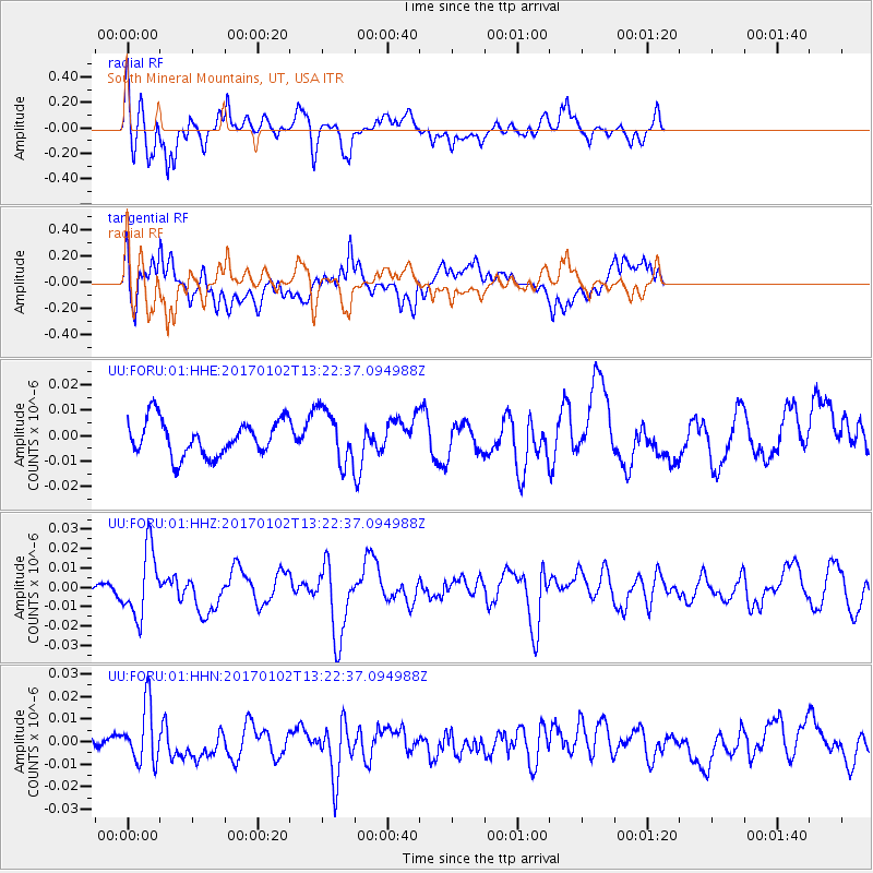
Signal To Noise
| Channel | StoN | STA | LTA |
| UU:FORU:01:HHZ:20170102T13:22:37.094988Z | 5.307876 | 1.7263215E-8 | 3.2523775E-9 |
| UU:FORU:01:HHN:20170102T13:22:37.094988Z | 2.8908327 | 1.2716907E-8 | 4.3990465E-9 |
| UU:FORU:01:HHE:20170102T13:22:37.094988Z | 1.5189791 | 1.0501407E-8 | 6.9134636E-9 |
| Arrivals |
| Ps | |
| PpPs | |
| PsPs/PpSs | |


