You are here: Home > Network List > TA - USArray Transportable Network (new EarthScope stations) Stations List
> Station E10A Myers Farm, Uniontown, WA, USA > Earthquake Result Viewer
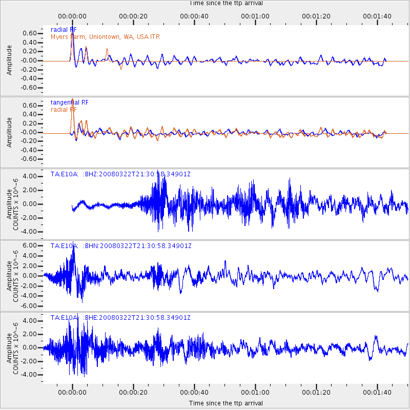
E10A Myers Farm, Uniontown, WA, USA - Earthquake Result Viewer
*The percent match for this event was below the threshold and hence no stack was calculated.
| Earthquake location: |
Andreanof Islands, Aleutian Is. |
| Earthquake latitude/longitude: |
52.2/-178.7 |
| Earthquake time(UTC): |
2008/03/22 (082) 21:24:11 GMT |
| Earthquake Depth: |
132 km |
| Earthquake Magnitude: |
5.8 MB, 6.2 MW, 6.1 MW |
| Earthquake Catalog/Contributor: |
WHDF/NEIC |
|
| Network: |
TA USArray Transportable Network (new EarthScope stations) |
| Station: |
E10A Myers Farm, Uniontown, WA, USA |
| Lat/Lon: |
46.49 N/117.11 W |
| Elevation: |
903 m |
|
| Distance: |
39.5 deg |
| Az: |
72.963 deg |
| Baz: |
301.558 deg |
| Ray Param: |
$rayparam |
*The percent match for this event was below the threshold and hence was not used in the summary stack. |
|
| Radial Match: |
78.13091 % |
| Radial Bump: |
400 |
| Transverse Match: |
66.431786 % |
| Transverse Bump: |
400 |
| SOD ConfigId: |
2504 |
| Insert Time: |
2010-03-07 03:09:47.012 +0000 |
| GWidth: |
2.5 |
| Max Bumps: |
400 |
| Tol: |
0.001 |
|
Signal To Noise
| Channel | StoN | STA | LTA |
| TA:E10A: :BHN:20080322T21:30:58.34901Z | 6.756223 | 2.4850274E-6 | 3.6781313E-7 |
| TA:E10A: :BHE:20080322T21:30:58.34901Z | 4.735803 | 1.999166E-6 | 4.2213873E-7 |
| TA:E10A: :BHZ:20080322T21:30:58.34901Z | 4.19589 | 1.5083697E-6 | 3.5948744E-7 |
| Arrivals |
| Ps | |
| PpPs | |
| PsPs/PpSs | |


