You are here: Home > Network List > AV - Alaska Volcano Observatory Stations List
> Station MAPS Pakushin Southeast, Makushin Volcano, Alaska > Earthquake Result Viewer
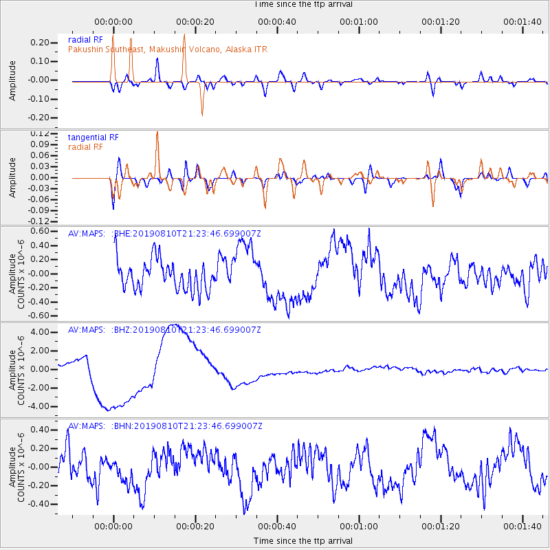
MAPS Pakushin Southeast, Makushin Volcano, Alaska - Earthquake Result Viewer
*The percent match for this event was below the threshold and hence no stack was calculated.
| Earthquake location: |
Southern Sumatra, Indonesia |
| Earthquake latitude/longitude: |
-0.8/99.4 |
| Earthquake time(UTC): |
2019/08/10 (222) 21:11:11 GMT |
| Earthquake Depth: |
51 km |
| Earthquake Magnitude: |
5.6 mb |
| Earthquake Catalog/Contributor: |
NEIC PDE/us |
|
| Network: |
AV Alaska Volcano Observatory |
| Station: |
MAPS Pakushin Southeast, Makushin Volcano, Alaska |
| Lat/Lon: |
53.81 N/166.94 W |
| Elevation: |
333 m |
|
| Distance: |
92.8 deg |
| Az: |
36.338 deg |
| Baz: |
272.532 deg |
| Ray Param: |
$rayparam |
*The percent match for this event was below the threshold and hence was not used in the summary stack. |
|
| Radial Match: |
76.43057 % |
| Radial Bump: |
400 |
| Transverse Match: |
54.326374 % |
| Transverse Bump: |
400 |
| SOD ConfigId: |
19053131 |
| Insert Time: |
2019-08-24 21:14:19.435 +0000 |
| GWidth: |
2.5 |
| Max Bumps: |
400 |
| Tol: |
0.001 |
|
Signal To Noise
| Channel | StoN | STA | LTA |
| AV:MAPS: :BHZ:20190810T21:23:46.699007Z | 7.5603366 | 4.689087E-6 | 6.2022195E-7 |
| AV:MAPS: :BHN:20190810T21:23:46.699007Z | 0.8022805 | 1.560691E-7 | 1.9453185E-7 |
| AV:MAPS: :BHE:20190810T21:23:46.699007Z | 1.9097576 | 4.0402026E-7 | 2.1155577E-7 |
| Arrivals |
| Ps | |
| PpPs | |
| PsPs/PpSs | |


