You are here: Home > Network List > TA - USArray Transportable Network (new EarthScope stations) Stations List
> Station S12A Delamar Landing Field, Caliente, NV, USA > Earthquake Result Viewer
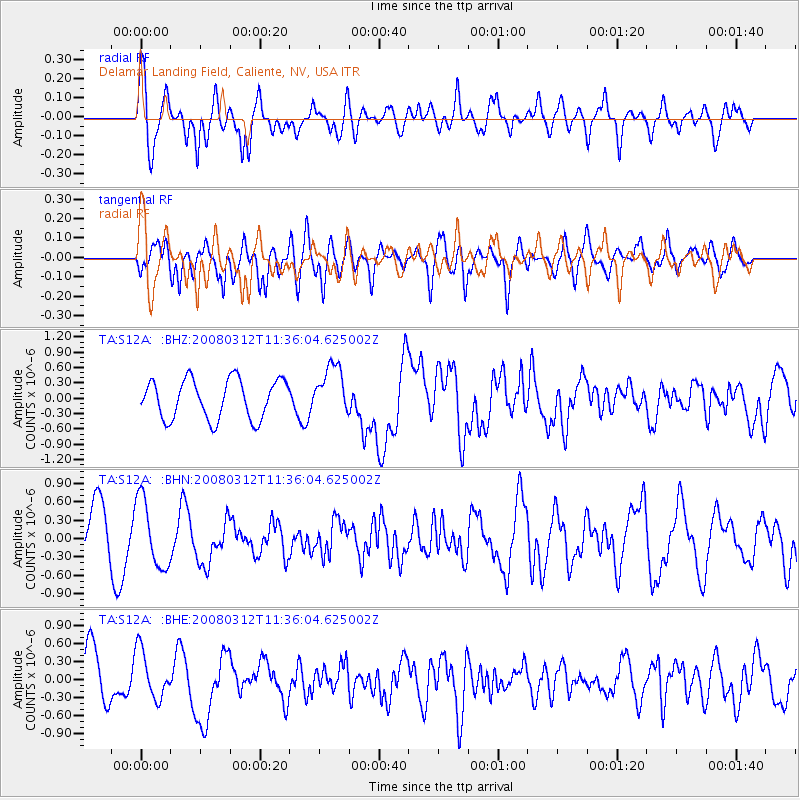
S12A Delamar Landing Field, Caliente, NV, USA - Earthquake Result Viewer

| Earthquake location: |
Vanuatu Islands |
| Earthquake latitude/longitude: |
-16.6/167.3 |
| Earthquake time(UTC): |
2008/03/12 (072) 11:23:34 GMT |
| Earthquake Depth: |
13 km |
| Earthquake Magnitude: |
5.8 MB, 6.4 MS, 6.4 MW, 6.4 MW |
| Earthquake Catalog/Contributor: |
WHDF/NEIC |
|
| Network: |
TA USArray Transportable Network (new EarthScope stations) |
| Station: |
S12A Delamar Landing Field, Caliente, NV, USA |
| Lat/Lon: |
37.61 N/114.85 W |
| Elevation: |
1479 m |
|
| Distance: |
90.7 deg |
| Az: |
50.927 deg |
| Baz: |
249.631 deg |
| Ray Param: |
0.041657273 |
| Estimated Moho Depth: |
27.0 km |
| Estimated Crust Vp/Vs: |
2.00 |
| Assumed Crust Vp: |
6.276 km/s |
| Estimated Crust Vs: |
3.134 km/s |
| Estimated Crust Poisson's Ratio: |
0.33 |
|
| Radial Match: |
80.49177 % |
| Radial Bump: |
400 |
| Transverse Match: |
70.705444 % |
| Transverse Bump: |
400 |
| SOD ConfigId: |
2564 |
| Insert Time: |
2010-03-07 03:12:34.067 +0000 |
| GWidth: |
2.5 |
| Max Bumps: |
400 |
| Tol: |
0.001 |
|
Signal To Noise
| Channel | StoN | STA | LTA |
| TA:S12A: :BHN:20080312T11:36:04.625002Z | 1.3934227 | 5.567804E-7 | 3.9957754E-7 |
| TA:S12A: :BHE:20080312T11:36:04.625002Z | 1.0418183 | 4.0533305E-7 | 3.8906313E-7 |
| TA:S12A: :BHZ:20080312T11:36:04.625002Z | 1.2732391 | 4.885935E-7 | 3.8374057E-7 |
| Arrivals |
| Ps | 4.4 SECOND |
| PpPs | 13 SECOND |
| PsPs/PpSs | 17 SECOND |


