You are here: Home > Network List > TA - USArray Transportable Network (new EarthScope stations) Stations List
> Station F20K Avaraart Lake, AK, USA > Earthquake Result Viewer
F20K Avaraart Lake, AK, USA - Earthquake Result Viewer
*The percent match for this event was below the threshold and hence no stack was calculated.
| Earthquake location: |
Near Coast Of Chiapas, Mexico |
| Earthquake latitude/longitude: |
16.0/-93.7 |
| Earthquake time(UTC): |
2019/08/12 (224) 20:39:35 GMT |
| Earthquake Depth: |
92 km |
| Earthquake Magnitude: |
5.5 Mww |
| Earthquake Catalog/Contributor: |
NEIC PDE/us |
|
| Network: |
TA USArray Transportable Network (new EarthScope stations) |
| Station: |
F20K Avaraart Lake, AK, USA |
| Lat/Lon: |
67.05 N/155.73 W |
| Elevation: |
136 m |
|
| Distance: |
64.6 deg |
| Az: |
337.459 deg |
| Baz: |
109.903 deg |
| Ray Param: |
$rayparam |
*The percent match for this event was below the threshold and hence was not used in the summary stack. |
|
| Radial Match: |
79.14801 % |
| Radial Bump: |
400 |
| Transverse Match: |
68.10272 % |
| Transverse Bump: |
400 |
| SOD ConfigId: |
19053131 |
| Insert Time: |
2019-08-26 20:45:22.422 +0000 |
| GWidth: |
2.5 |
| Max Bumps: |
400 |
| Tol: |
0.001 |
|
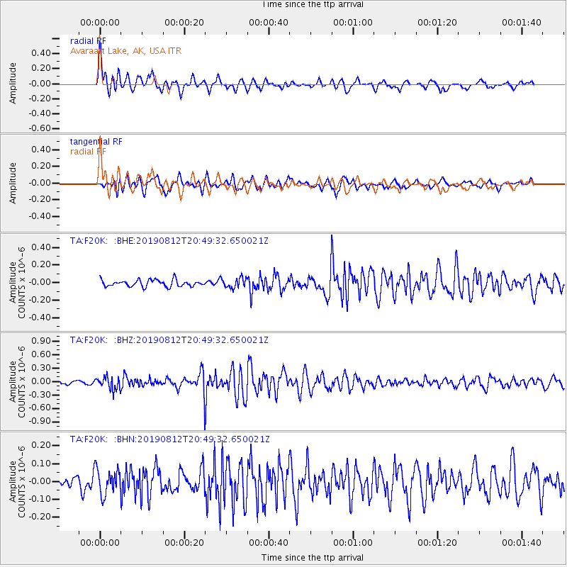
Signal To Noise
| Channel | StoN | STA | LTA |
| TA:F20K: :BHZ:20190812T20:49:32.650021Z | 3.0711129 | 1.4026311E-7 | 4.5671754E-8 |
| TA:F20K: :BHN:20190812T20:49:32.650021Z | 2.338444 | 6.823959E-8 | 2.9181624E-8 |
| TA:F20K: :BHE:20190812T20:49:32.650021Z | 1.4503382 | 5.400972E-8 | 3.72394E-8 |
| Arrivals |
| Ps | |
| PpPs | |
| PsPs/PpSs | |


