You are here: Home > Network List > TA - USArray Transportable Network (new EarthScope stations) Stations List
> Station J26L Joseph Creek, AK, USA > Earthquake Result Viewer
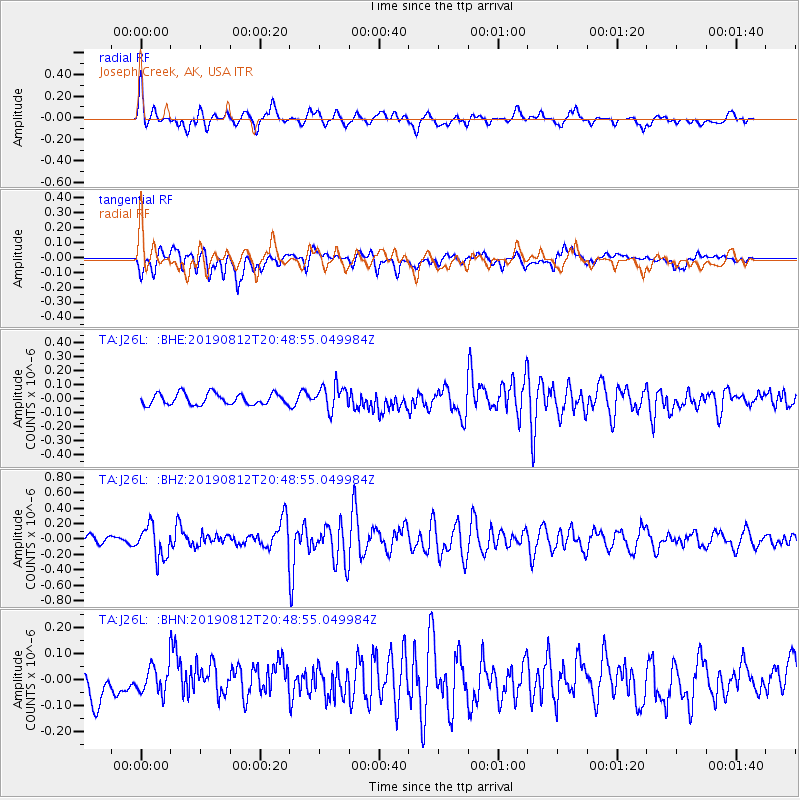
J26L Joseph Creek, AK, USA - Earthquake Result Viewer
*The percent match for this event was below the threshold and hence no stack was calculated.
| Earthquake location: |
Near Coast Of Chiapas, Mexico |
| Earthquake latitude/longitude: |
16.0/-93.7 |
| Earthquake time(UTC): |
2019/08/12 (224) 20:39:35 GMT |
| Earthquake Depth: |
92 km |
| Earthquake Magnitude: |
5.5 Mww |
| Earthquake Catalog/Contributor: |
NEIC PDE/us |
|
| Network: |
TA USArray Transportable Network (new EarthScope stations) |
| Station: |
J26L Joseph Creek, AK, USA |
| Lat/Lon: |
64.50 N/143.56 W |
| Elevation: |
1144 m |
|
| Distance: |
59.0 deg |
| Az: |
337.29 deg |
| Baz: |
120.911 deg |
| Ray Param: |
$rayparam |
*The percent match for this event was below the threshold and hence was not used in the summary stack. |
|
| Radial Match: |
70.448 % |
| Radial Bump: |
400 |
| Transverse Match: |
73.850975 % |
| Transverse Bump: |
400 |
| SOD ConfigId: |
19053131 |
| Insert Time: |
2019-08-26 20:45:40.943 +0000 |
| GWidth: |
2.5 |
| Max Bumps: |
400 |
| Tol: |
0.001 |
|
Signal To Noise
| Channel | StoN | STA | LTA |
| TA:J26L: :BHZ:20190812T20:48:55.049984Z | 5.3531547 | 2.0699395E-7 | 3.8667658E-8 |
| TA:J26L: :BHN:20190812T20:48:55.049984Z | 0.88400334 | 5.1655288E-8 | 5.8433365E-8 |
| TA:J26L: :BHE:20190812T20:48:55.049984Z | 2.2133217 | 8.807861E-8 | 3.979476E-8 |
| Arrivals |
| Ps | |
| PpPs | |
| PsPs/PpSs | |


