You are here: Home > Network List > US - United States National Seismic Network Stations List
> Station DUG Dugway, Tooele County, Utah, USA > Earthquake Result Viewer
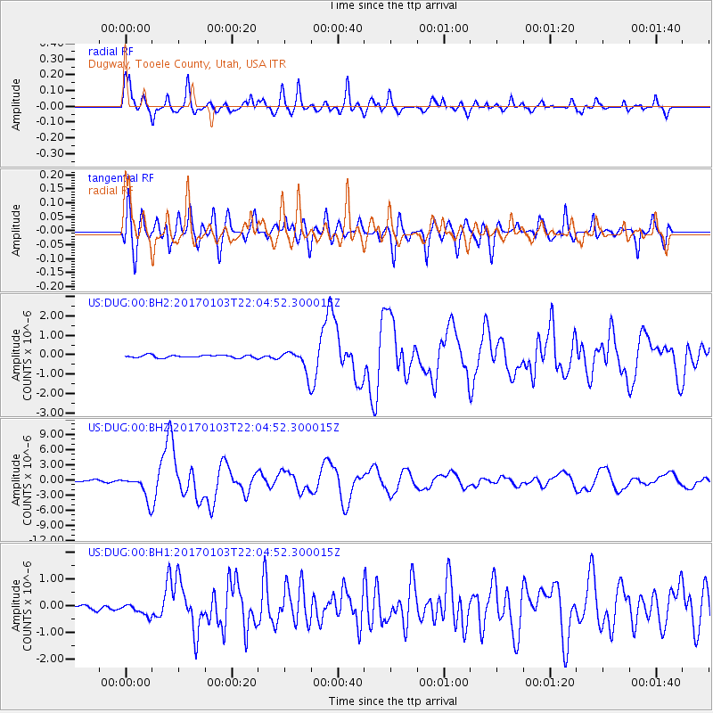
DUG Dugway, Tooele County, Utah, USA - Earthquake Result Viewer
*The percent match for this event was below the threshold and hence no stack was calculated.
| Earthquake location: |
South Of Fiji Islands |
| Earthquake latitude/longitude: |
-19.3/176.1 |
| Earthquake time(UTC): |
2017/01/03 (003) 21:52:31 GMT |
| Earthquake Depth: |
17 km |
| Earthquake Magnitude: |
6.9 Mww |
| Earthquake Catalog/Contributor: |
NEIC PDE/us |
|
| Network: |
US United States National Seismic Network |
| Station: |
DUG Dugway, Tooele County, Utah, USA |
| Lat/Lon: |
40.19 N/112.81 W |
| Elevation: |
1477 m |
|
| Distance: |
88.7 deg |
| Az: |
46.47 deg |
| Baz: |
243.359 deg |
| Ray Param: |
$rayparam |
*The percent match for this event was below the threshold and hence was not used in the summary stack. |
|
| Radial Match: |
90.00023 % |
| Radial Bump: |
400 |
| Transverse Match: |
85.85055 % |
| Transverse Bump: |
400 |
| SOD ConfigId: |
1943534 |
| Insert Time: |
2017-01-17 21:55:17.960 +0000 |
| GWidth: |
2.5 |
| Max Bumps: |
400 |
| Tol: |
0.001 |
|
Signal To Noise
| Channel | StoN | STA | LTA |
| US:DUG:00:BHZ:20170103T22:04:52.300015Z | 15.07321 | 2.4736778E-6 | 1.6411089E-7 |
| US:DUG:00:BH1:20170103T22:04:52.300015Z | 1.5092403 | 2.2771675E-7 | 1.508817E-7 |
| US:DUG:00:BH2:20170103T22:04:52.300015Z | 8.559479 | 6.0181577E-7 | 7.030986E-8 |
| Arrivals |
| Ps | |
| PpPs | |
| PsPs/PpSs | |


