You are here: Home > Network List > TA - USArray Transportable Network (new EarthScope stations) Stations List
> Station P17K Kvichak River, AK, USA > Earthquake Result Viewer
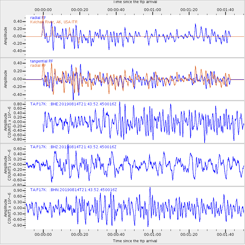
P17K Kvichak River, AK, USA - Earthquake Result Viewer
*The percent match for this event was below the threshold and hence no stack was calculated.
| Earthquake location: |
Revilla Gigedo Islands Region |
| Earthquake latitude/longitude: |
20.5/-109.2 |
| Earthquake time(UTC): |
2019/08/14 (226) 21:35:19 GMT |
| Earthquake Depth: |
10 km |
| Earthquake Magnitude: |
5.8 Mww |
| Earthquake Catalog/Contributor: |
NEIC PDE/us |
|
| Network: |
TA USArray Transportable Network (new EarthScope stations) |
| Station: |
P17K Kvichak River, AK, USA |
| Lat/Lon: |
59.20 N/156.44 W |
| Elevation: |
91 m |
|
| Distance: |
51.2 deg |
| Az: |
331.04 deg |
| Baz: |
118.098 deg |
| Ray Param: |
$rayparam |
*The percent match for this event was below the threshold and hence was not used in the summary stack. |
|
| Radial Match: |
60.59293 % |
| Radial Bump: |
400 |
| Transverse Match: |
49.33342 % |
| Transverse Bump: |
400 |
| SOD ConfigId: |
19053131 |
| Insert Time: |
2019-08-28 21:44:27.840 +0000 |
| GWidth: |
2.5 |
| Max Bumps: |
400 |
| Tol: |
0.001 |
|
Signal To Noise
| Channel | StoN | STA | LTA |
| TA:P17K: :BHZ:20190814T21:43:52.450016Z | 2.201827 | 1.9856681E-7 | 9.0182745E-8 |
| TA:P17K: :BHN:20190814T21:43:52.450016Z | 0.9368302 | 1.8910052E-7 | 2.0185142E-7 |
| TA:P17K: :BHE:20190814T21:43:52.450016Z | 1.5131413 | 3.053851E-7 | 2.0182193E-7 |
| Arrivals |
| Ps | |
| PpPs | |
| PsPs/PpSs | |


