You are here: Home > Network List > US - United States National Seismic Network Stations List
> Station OGNE Ogallala, Nebraska, USA > Earthquake Result Viewer
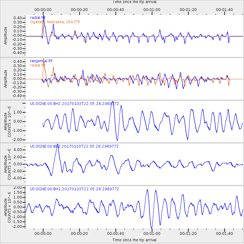
OGNE Ogallala, Nebraska, USA - Earthquake Result Viewer
*The percent match for this event was below the threshold and hence no stack was calculated.
| Earthquake location: |
South Of Fiji Islands |
| Earthquake latitude/longitude: |
-19.3/176.1 |
| Earthquake time(UTC): |
2017/01/03 (003) 21:52:31 GMT |
| Earthquake Depth: |
17 km |
| Earthquake Magnitude: |
6.9 Mww |
| Earthquake Catalog/Contributor: |
NEIC PDE/us |
|
| Network: |
US United States National Seismic Network |
| Station: |
OGNE Ogallala, Nebraska, USA |
| Lat/Lon: |
40.95 N/102.03 W |
| Elevation: |
1054 m |
|
| Distance: |
96.6 deg |
| Az: |
49.018 deg |
| Baz: |
250.238 deg |
| Ray Param: |
$rayparam |
*The percent match for this event was below the threshold and hence was not used in the summary stack. |
|
| Radial Match: |
73.51928 % |
| Radial Bump: |
400 |
| Transverse Match: |
67.39289 % |
| Transverse Bump: |
400 |
| SOD ConfigId: |
1943534 |
| Insert Time: |
2017-01-17 21:56:00.631 +0000 |
| GWidth: |
2.5 |
| Max Bumps: |
400 |
| Tol: |
0.001 |
|
Signal To Noise
| Channel | StoN | STA | LTA |
| US:OGNE:00:BHZ:20170103T22:05:28.298977Z | 9.313592 | 1.3613757E-6 | 1.4617085E-7 |
| US:OGNE:00:BH1:20170103T22:05:28.298977Z | 0.5937342 | 3.3202872E-7 | 5.592211E-7 |
| US:OGNE:00:BH2:20170103T22:05:28.298977Z | 0.7394734 | 4.4182954E-7 | 5.974921E-7 |
| Arrivals |
| Ps | |
| PpPs | |
| PsPs/PpSs | |


