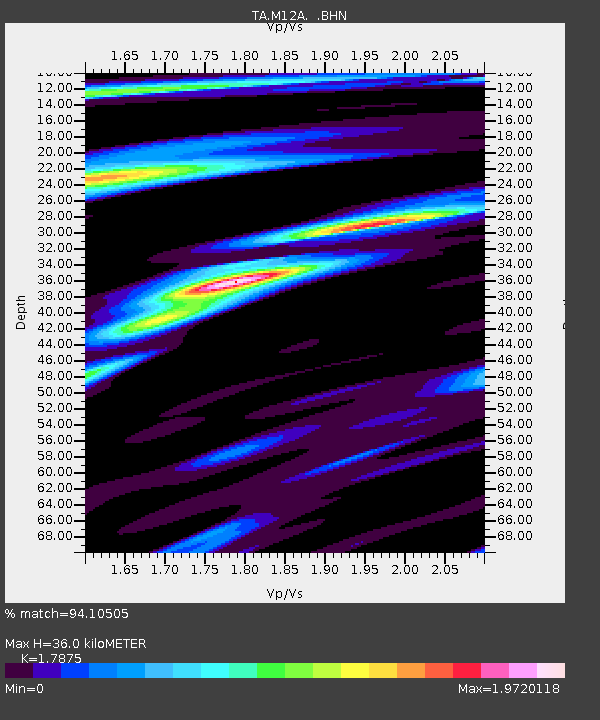
M12A Wells, NV, USA - Earthquake Result Viewer
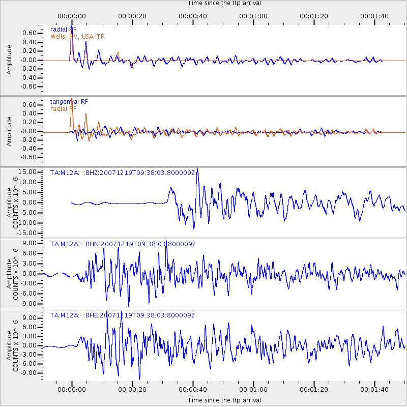
Earthquake location: Andreanof Islands, Aleutian Is.
Earthquake latitude/longitude: 51.4/-179.5
Earthquake time(UTC): 2007/12/19 (353) 09:30:27 GMT
Earthquake Depth: 29 km
Earthquake Magnitude: 6.4 MB, 7.1 MS, 7.1 MW, 7.0 MW
Earthquake Catalog/Contributor: WHDF/NEIC
Network: TA USArray Transportable Network (new EarthScope stations)
Station: M12A Wells, NV, USA
Lat/Lon: 41.42 N/114.92 W
Elevation: 1930 m
Distance: 44.3 deg
Az: 76.598 deg
Baz: 305.82 deg
Ray Param: 0.07194481
Estimated Moho Depth: 36.0 km
Estimated Crust Vp/Vs: 1.79
Assumed Crust Vp: 6.276 km/s
Estimated Crust Vs: 3.511 km/s
Estimated Crust Poisson's Ratio: 0.27
Radial Match: 94.10505 %
Radial Bump: 400
Transverse Match: 79.293686 %
Transverse Bump: 400
SOD ConfigId: 2564
Insert Time: 2010-03-07 03:16:58.942 +0000
GWidth: 2.5
Max Bumps: 400
Tol: 0.001

Signal To Noise

ChannelStoNSTALTA
TA:M12A: :BHN:20071219T09:38:03.800009Z4.4346969.985256E-72.2516211E-7
TA:M12A: :BHE:20071219T09:38:03.800009Z9.8120581.5094153E-61.5383267E-7
TA:M12A: :BHZ:20071219T09:38:03.800009Z11.417193.6561087E-63.2022842E-7
Arrivals
Ps4.8 SECOND
PpPs15 SECOND
PsPs/PpSs20 SECOND