
M12A Wells, NV, USA - Earthquake Result Viewer
| ||||||||||||||||||
| ||||||||||||||||||
| ||||||||||||||||||
|
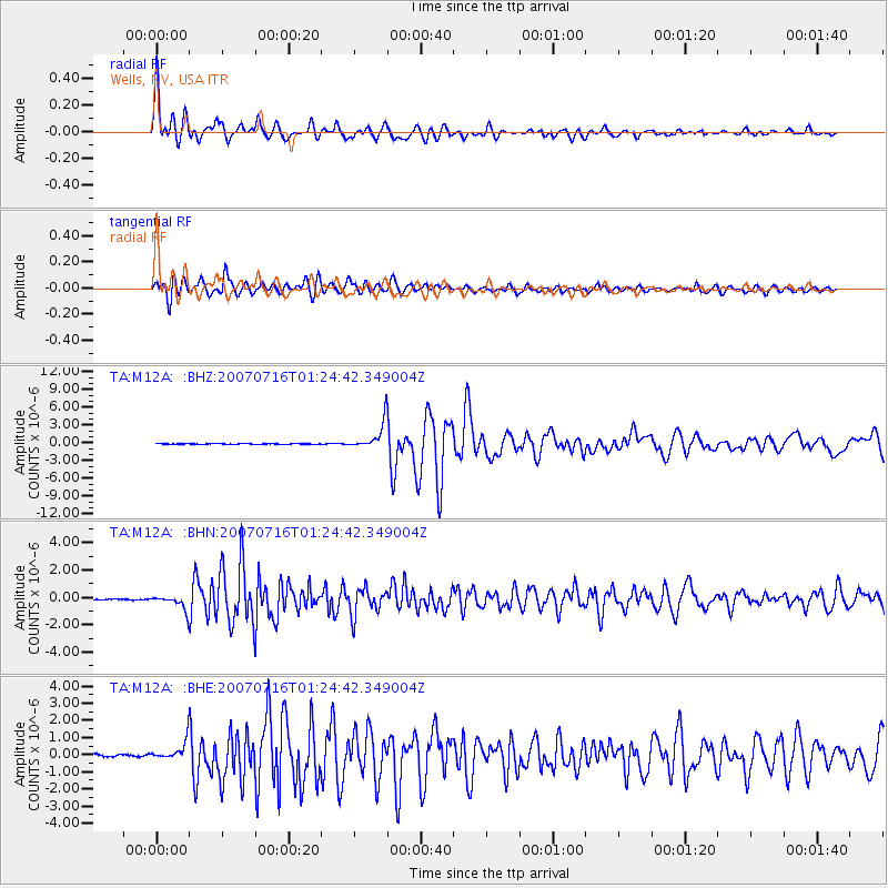
Signal To Noise
| Channel | StoN | STA | LTA |
| TA:M12A: :BHN:20070716T01:24:42.349004Z | 10.504965 | 5.188E-7 | 4.9386173E-8 |
| TA:M12A: :BHE:20070716T01:24:42.349004Z | 7.096229 | 5.41138E-7 | 7.6257116E-8 |
| TA:M12A: :BHZ:20070716T01:24:42.349004Z | 33.122593 | 2.2920347E-6 | 6.9198535E-8 |
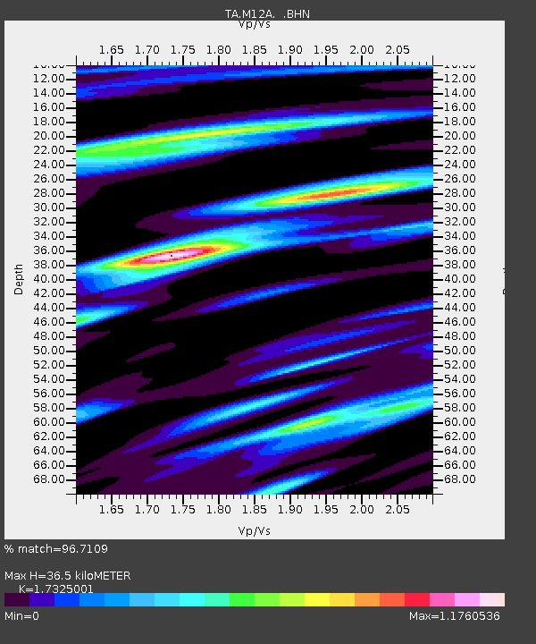
| Arrivals | |
| Ps | 4.4 SECOND |
| PpPs | 15 SECOND |
| PsPs/PpSs | 20 SECOND |

