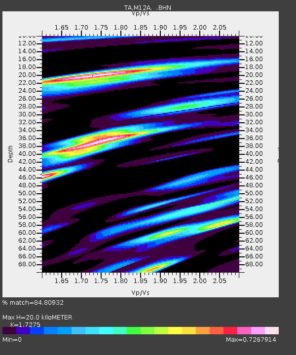
M12A Wells, NV, USA - Earthquake Result Viewer
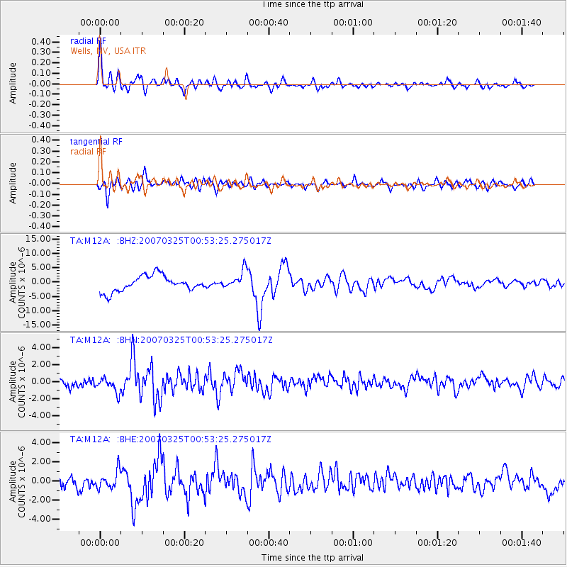
Earthquake location: Near West Coast Of Honshu, Japan
Earthquake latitude/longitude: 37.3/136.6
Earthquake time(UTC): 2007/03/25 (084) 00:41:57 GMT
Earthquake Depth: 8.0 km
Earthquake Magnitude: 6.1 MB, 6.8 MS, 6.7 MW, 6.6 MW
Earthquake Catalog/Contributor: WHDF/NEIC
Network: TA USArray Transportable Network (new EarthScope stations)
Station: M12A Wells, NV, USA
Lat/Lon: 41.42 N/114.92 W
Elevation: 1930 m
Distance: 78.0 deg
Az: 46.819 deg
Baz: 309.399 deg
Ray Param: 0.049939074
Estimated Moho Depth: 20.0 km
Estimated Crust Vp/Vs: 1.73
Assumed Crust Vp: 6.276 km/s
Estimated Crust Vs: 3.633 km/s
Estimated Crust Poisson's Ratio: 0.25
Radial Match: 84.80932 %
Radial Bump: 400
Transverse Match: 73.249664 %
Transverse Bump: 400
SOD ConfigId: 2564
Insert Time: 2010-03-07 03:17:49.963 +0000
GWidth: 2.5
Max Bumps: 400
Tol: 0.001

Signal To Noise

ChannelStoNSTALTA
TA:M12A: :BHN:20070325T00:53:25.275017Z1.42921078.5914996E-76.01136E-7
TA:M12A: :BHE:20070325T00:53:25.275017Z1.01032579.4755177E-79.3786764E-7
TA:M12A: :BHZ:20070325T00:53:25.275017Z1.21738853.3034714E-62.713572E-6
Arrivals
Ps2.4 SECOND
PpPs8.4 SECOND
PsPs/PpSs11 SECOND