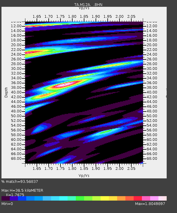
M12A Wells, NV, USA - Earthquake Result Viewer
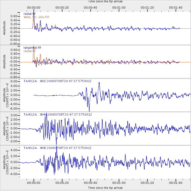
Earthquake location: Andreanof Islands, Aleutian Is.
Earthquake latitude/longitude: 51.2/-179.3
Earthquake time(UTC): 2006/07/08 (189) 20:40:00 GMT
Earthquake Depth: 22 km
Earthquake Magnitude: 6.2 MB, 6.4 MS, 6.6 MW, 6.6 MW
Earthquake Catalog/Contributor: WHDF/NEIC
Network: TA USArray Transportable Network (new EarthScope stations)
Station: M12A Wells, NV, USA
Lat/Lon: 41.42 N/114.92 W
Elevation: 1930 m
Distance: 44.2 deg
Az: 76.582 deg
Baz: 305.568 deg
Ray Param: 0.07202429
Estimated Moho Depth: 36.5 km
Estimated Crust Vp/Vs: 1.77
Assumed Crust Vp: 6.276 km/s
Estimated Crust Vs: 3.551 km/s
Estimated Crust Poisson's Ratio: 0.26
Radial Match: 93.56837 %
Radial Bump: 400
Transverse Match: 90.39509 %
Transverse Bump: 400
SOD ConfigId: 2665
Insert Time: 2010-03-07 03:18:36.884 +0000
GWidth: 2.5
Max Bumps: 400
Tol: 0.001

Signal To Noise

ChannelStoNSTALTA
TA:M12A: :BHN:20060708T20:47:37.575001Z5.22907263.072988E-75.876736E-8
TA:M12A: :BHE:20060708T20:47:37.575001Z4.0663344.2142048E-71.03636474E-7
TA:M12A: :BHZ:20060708T20:47:37.575001Z8.1558616.710659E-78.22802E-8
Arrivals
Ps4.7 SECOND
PpPs15 SECOND
PsPs/PpSs20 SECOND