
M12A Wells, NV, USA - Earthquake Result Viewer
| ||||||||||||||||||
| ||||||||||||||||||
| ||||||||||||||||||
|
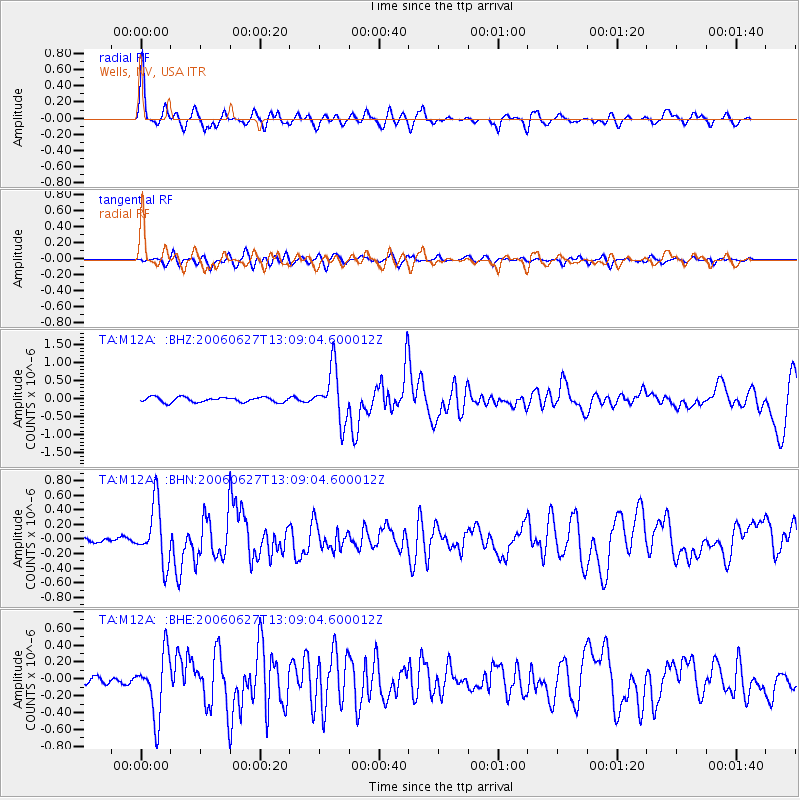
Signal To Noise
| Channel | StoN | STA | LTA |
| TA:M12A: :BHN:20060627T13:09:04.600012Z | 10.287981 | 4.004737E-7 | 3.8926366E-8 |
| TA:M12A: :BHE:20060627T13:09:04.600012Z | 8.805985 | 3.6900244E-7 | 4.1903593E-8 |
| TA:M12A: :BHZ:20060627T13:09:04.600012Z | 10.620026 | 7.2127676E-7 | 6.7916666E-8 |
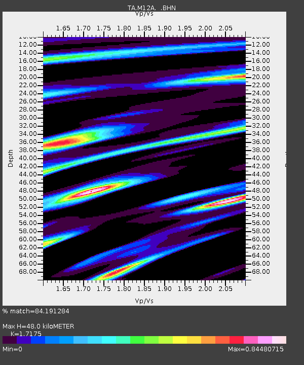
| Arrivals | |
| Ps | 5.9 SECOND |
| PpPs | 19 SECOND |
| PsPs/PpSs | 25 SECOND |

