You are here: Home > Network List > US - United States National Seismic Network Stations List
> Station ELK Elko, Nevada, USA > Earthquake Result Viewer
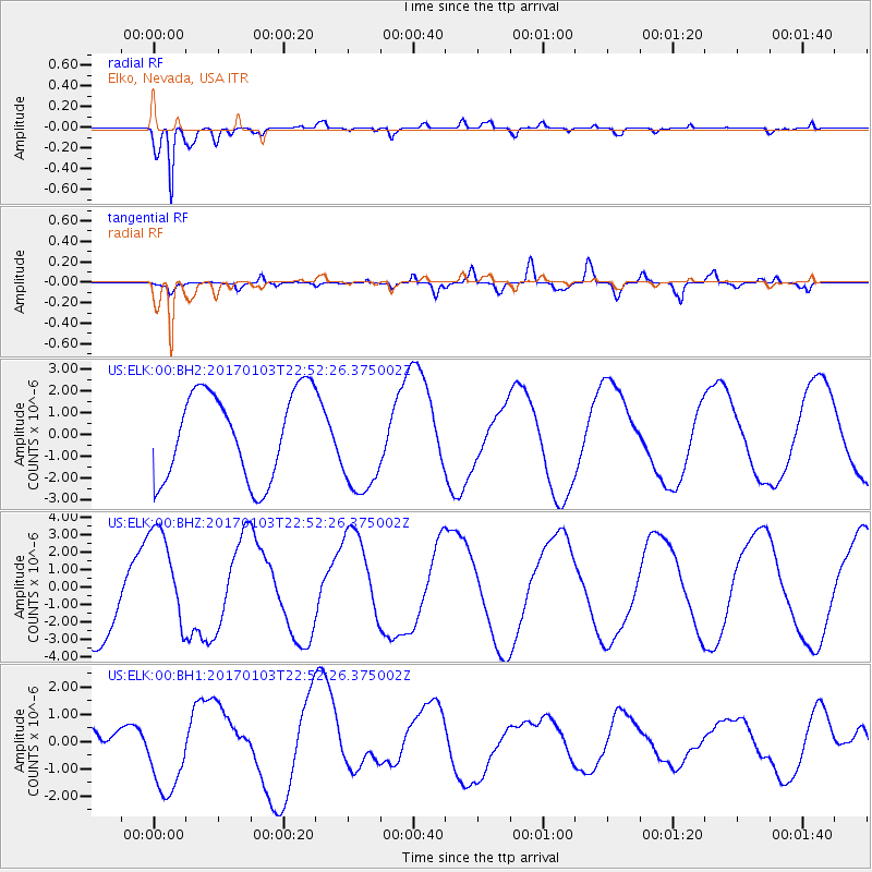
ELK Elko, Nevada, USA - Earthquake Result Viewer
*The percent match for this event was below the threshold and hence no stack was calculated.
| Earthquake location: |
South Of Fiji Islands |
| Earthquake latitude/longitude: |
-19.1/176.2 |
| Earthquake time(UTC): |
2017/01/03 (003) 22:40:12 GMT |
| Earthquake Depth: |
10 km |
| Earthquake Magnitude: |
5.8 mb |
| Earthquake Catalog/Contributor: |
NEIC PDE/us |
|
| Network: |
US United States National Seismic Network |
| Station: |
ELK Elko, Nevada, USA |
| Lat/Lon: |
40.74 N/115.24 W |
| Elevation: |
2210 m |
|
| Distance: |
87.1 deg |
| Az: |
45.082 deg |
| Baz: |
241.776 deg |
| Ray Param: |
$rayparam |
*The percent match for this event was below the threshold and hence was not used in the summary stack. |
|
| Radial Match: |
94.125854 % |
| Radial Bump: |
315 |
| Transverse Match: |
71.72723 % |
| Transverse Bump: |
400 |
| SOD ConfigId: |
1943534 |
| Insert Time: |
2017-01-17 22:44:29.736 +0000 |
| GWidth: |
2.5 |
| Max Bumps: |
400 |
| Tol: |
0.001 |
|
Signal To Noise
| Channel | StoN | STA | LTA |
| US:ELK:00:BHZ:20170103T22:52:26.375002Z | 1.1887008 | 2.9964842E-6 | 2.5208062E-6 |
| US:ELK:00:BH1:20170103T22:52:26.375002Z | 4.076123 | 1.5013226E-6 | 3.683212E-7 |
| US:ELK:00:BH2:20170103T22:52:26.375002Z | 1.1932207 | 2.3726022E-6 | 1.9884017E-6 |
| Arrivals |
| Ps | |
| PpPs | |
| PsPs/PpSs | |


