You are here: Home > Network List > AV - Alaska Volcano Observatory Stations List
> Station SPCR Ckakachatna River, Mount Spurr, Alaska > Earthquake Result Viewer
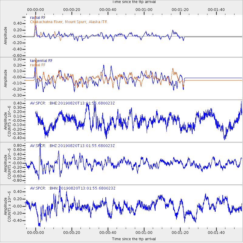
SPCR Ckakachatna River, Mount Spurr, Alaska - Earthquake Result Viewer
*The percent match for this event was below the threshold and hence no stack was calculated.
| Earthquake location: |
Ryukyu Islands, Japan |
| Earthquake latitude/longitude: |
28.0/130.9 |
| Earthquake time(UTC): |
2019/08/20 (232) 12:52:22 GMT |
| Earthquake Depth: |
10 km |
| Earthquake Magnitude: |
5.2 Mww |
| Earthquake Catalog/Contributor: |
NEIC PDE/us |
|
| Network: |
AV Alaska Volcano Observatory |
| Station: |
SPCR Ckakachatna River, Mount Spurr, Alaska |
| Lat/Lon: |
61.20 N/152.21 W |
| Elevation: |
984 m |
|
| Distance: |
59.7 deg |
| Az: |
33.126 deg |
| Baz: |
273.359 deg |
| Ray Param: |
$rayparam |
*The percent match for this event was below the threshold and hence was not used in the summary stack. |
|
| Radial Match: |
33.658688 % |
| Radial Bump: |
376 |
| Transverse Match: |
62.20454 % |
| Transverse Bump: |
400 |
| SOD ConfigId: |
19053131 |
| Insert Time: |
2019-09-03 12:55:22.991 +0000 |
| GWidth: |
2.5 |
| Max Bumps: |
400 |
| Tol: |
0.001 |
|
Signal To Noise
| Channel | StoN | STA | LTA |
| AV:SPCR: :BHZ:20190820T13:01:55.680023Z | 1.9866829 | 4.4112582E-7 | 2.2204138E-7 |
| AV:SPCR: :BHN:20190820T13:01:55.680023Z | 1.4483292 | 2.8888513E-7 | 1.9946096E-7 |
| AV:SPCR: :BHE:20190820T13:01:55.680023Z | 1.5316055 | 2.1148361E-7 | 1.3807968E-7 |
| Arrivals |
| Ps | |
| PpPs | |
| PsPs/PpSs | |


