You are here: Home > Network List > US - United States National Seismic Network Stations List
> Station HAWA Hanford, Washington, USA > Earthquake Result Viewer
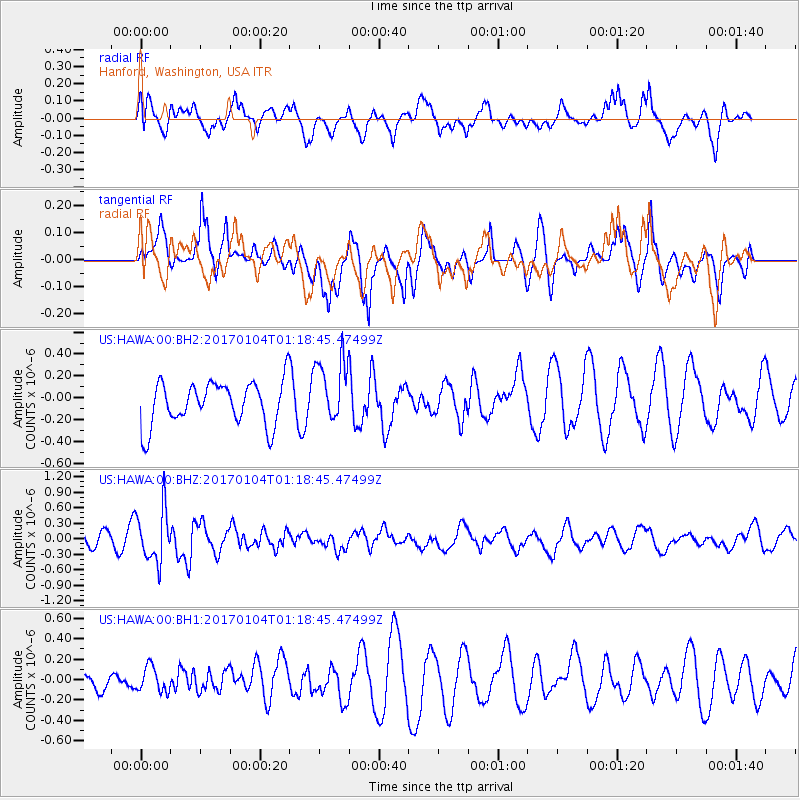
HAWA Hanford, Washington, USA - Earthquake Result Viewer
*The percent match for this event was below the threshold and hence no stack was calculated.
| Earthquake location: |
Vanuatu Islands |
| Earthquake latitude/longitude: |
-17.9/167.1 |
| Earthquake time(UTC): |
2017/01/04 (004) 01:06:10 GMT |
| Earthquake Depth: |
15 km |
| Earthquake Magnitude: |
5.7 mb |
| Earthquake Catalog/Contributor: |
NEIC PDE/us |
|
| Network: |
US United States National Seismic Network |
| Station: |
HAWA Hanford, Washington, USA |
| Lat/Lon: |
46.39 N/119.53 W |
| Elevation: |
364 m |
|
| Distance: |
91.8 deg |
| Az: |
41.558 deg |
| Baz: |
245.894 deg |
| Ray Param: |
$rayparam |
*The percent match for this event was below the threshold and hence was not used in the summary stack. |
|
| Radial Match: |
47.28341 % |
| Radial Bump: |
400 |
| Transverse Match: |
44.53612 % |
| Transverse Bump: |
365 |
| SOD ConfigId: |
1943534 |
| Insert Time: |
2017-01-18 01:09:48.225 +0000 |
| GWidth: |
2.5 |
| Max Bumps: |
400 |
| Tol: |
0.001 |
|
Signal To Noise
| Channel | StoN | STA | LTA |
| US:HAWA:00:BHZ:20170104T01:18:45.47499Z | 3.1321576 | 5.009948E-7 | 1.5995198E-7 |
| US:HAWA:00:BH1:20170104T01:18:45.47499Z | 1.0111806 | 1.2244433E-7 | 1.2109047E-7 |
| US:HAWA:00:BH2:20170104T01:18:45.47499Z | 1.4949226 | 2.9875028E-7 | 1.9984331E-7 |
| Arrivals |
| Ps | |
| PpPs | |
| PsPs/PpSs | |


