You are here: Home > Network List > TA - USArray Transportable Network (new EarthScope stations) Stations List
> Station G16K Koyuk River, AK, USA > Earthquake Result Viewer
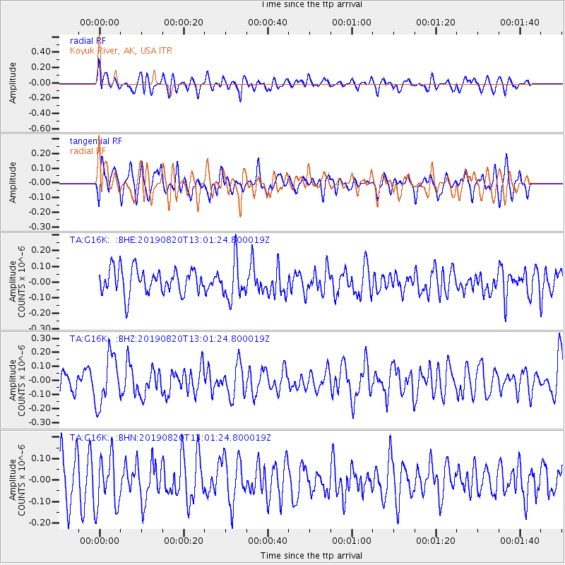
G16K Koyuk River, AK, USA - Earthquake Result Viewer
*The percent match for this event was below the threshold and hence no stack was calculated.
| Earthquake location: |
Ryukyu Islands, Japan |
| Earthquake latitude/longitude: |
28.0/130.9 |
| Earthquake time(UTC): |
2019/08/20 (232) 12:52:22 GMT |
| Earthquake Depth: |
10 km |
| Earthquake Magnitude: |
5.2 Mww |
| Earthquake Catalog/Contributor: |
NEIC PDE/us |
|
| Network: |
TA USArray Transportable Network (new EarthScope stations) |
| Station: |
G16K Koyuk River, AK, USA |
| Lat/Lon: |
65.39 N/162.35 W |
| Elevation: |
169 m |
|
| Distance: |
55.3 deg |
| Az: |
27.912 deg |
| Baz: |
261.49 deg |
| Ray Param: |
$rayparam |
*The percent match for this event was below the threshold and hence was not used in the summary stack. |
|
| Radial Match: |
45.94202 % |
| Radial Bump: |
400 |
| Transverse Match: |
49.384262 % |
| Transverse Bump: |
400 |
| SOD ConfigId: |
19053131 |
| Insert Time: |
2019-09-03 12:59:38.045 +0000 |
| GWidth: |
2.5 |
| Max Bumps: |
400 |
| Tol: |
0.001 |
|
Signal To Noise
| Channel | StoN | STA | LTA |
| TA:G16K: :BHZ:20190820T13:01:24.800019Z | 2.6218798 | 1.7804378E-7 | 6.790692E-8 |
| TA:G16K: :BHN:20190820T13:01:24.800019Z | 1.2544858 | 1.1657046E-7 | 9.29229E-8 |
| TA:G16K: :BHE:20190820T13:01:24.800019Z | 1.6048212 | 1.2641921E-7 | 7.877463E-8 |
| Arrivals |
| Ps | |
| PpPs | |
| PsPs/PpSs | |


