You are here: Home > Network List > TA - USArray Transportable Network (new EarthScope stations) Stations List
> Station O17K Koliganek, Bristol Bay, AK, USA > Earthquake Result Viewer
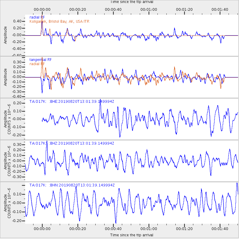
O17K Koliganek, Bristol Bay, AK, USA - Earthquake Result Viewer
*The percent match for this event was below the threshold and hence no stack was calculated.
| Earthquake location: |
Ryukyu Islands, Japan |
| Earthquake latitude/longitude: |
28.0/130.9 |
| Earthquake time(UTC): |
2019/08/20 (232) 12:52:22 GMT |
| Earthquake Depth: |
10 km |
| Earthquake Magnitude: |
5.2 Mww |
| Earthquake Catalog/Contributor: |
NEIC PDE/us |
|
| Network: |
TA USArray Transportable Network (new EarthScope stations) |
| Station: |
O17K Koliganek, Bristol Bay, AK, USA |
| Lat/Lon: |
59.77 N/157.09 W |
| Elevation: |
156 m |
|
| Distance: |
57.3 deg |
| Az: |
34.887 deg |
| Baz: |
270.035 deg |
| Ray Param: |
$rayparam |
*The percent match for this event was below the threshold and hence was not used in the summary stack. |
|
| Radial Match: |
65.66955 % |
| Radial Bump: |
396 |
| Transverse Match: |
53.574993 % |
| Transverse Bump: |
310 |
| SOD ConfigId: |
19053131 |
| Insert Time: |
2019-09-03 13:00:25.196 +0000 |
| GWidth: |
2.5 |
| Max Bumps: |
400 |
| Tol: |
0.001 |
|
Signal To Noise
| Channel | StoN | STA | LTA |
| TA:O17K: :BHZ:20190820T13:01:39.149994Z | 1.6834881 | 1.4296256E-7 | 8.4920444E-8 |
| TA:O17K: :BHN:20190820T13:01:39.149994Z | 0.33485627 | 3.156021E-8 | 9.425002E-8 |
| TA:O17K: :BHE:20190820T13:01:39.149994Z | 2.711563 | 1.1308373E-7 | 4.170426E-8 |
| Arrivals |
| Ps | |
| PpPs | |
| PsPs/PpSs | |


