
Q07A Schurz, NV, USA - Earthquake Result Viewer
| ||||||||||||||||||
| ||||||||||||||||||
| ||||||||||||||||||
|
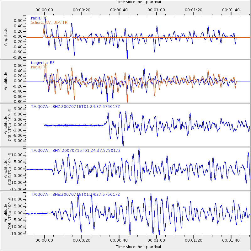
Signal To Noise
| Channel | StoN | STA | LTA |
| TA:Q07A: :BHN:20070716T01:24:37.575017Z | 3.4603443 | 6.703481E-7 | 1.9372294E-7 |
| TA:Q07A: :BHE:20070716T01:24:37.575017Z | 1.7881577 | 5.451977E-7 | 3.048935E-7 |
| TA:Q07A: :BHZ:20070716T01:24:37.575017Z | 16.786404 | 2.2666607E-6 | 1.3502957E-7 |
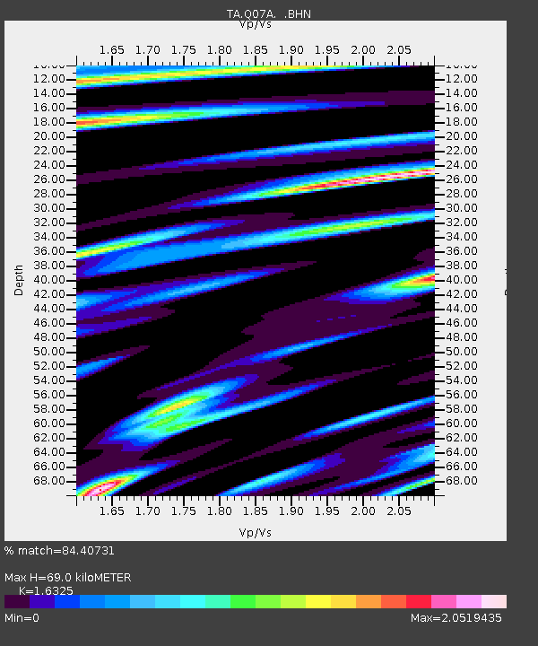
| Arrivals | |
| Ps | 7.2 SECOND |
| PpPs | 28 SECOND |
| PsPs/PpSs | 35 SECOND |

