You are here: Home > Network List > US - United States National Seismic Network Stations List
> Station DGMT Dagmar, Montana, USA > Earthquake Result Viewer
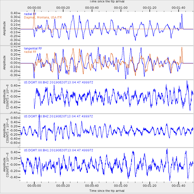
DGMT Dagmar, Montana, USA - Earthquake Result Viewer
*The percent match for this event was below the threshold and hence no stack was calculated.
| Earthquake location: |
Ryukyu Islands, Japan |
| Earthquake latitude/longitude: |
28.0/130.9 |
| Earthquake time(UTC): |
2019/08/20 (232) 12:52:22 GMT |
| Earthquake Depth: |
10 km |
| Earthquake Magnitude: |
5.2 Mww |
| Earthquake Catalog/Contributor: |
NEIC PDE/us |
|
| Network: |
US United States National Seismic Network |
| Station: |
DGMT Dagmar, Montana, USA |
| Lat/Lon: |
48.47 N/104.20 W |
| Elevation: |
0.0 m |
|
| Distance: |
89.4 deg |
| Az: |
33.071 deg |
| Baz: |
313.505 deg |
| Ray Param: |
$rayparam |
*The percent match for this event was below the threshold and hence was not used in the summary stack. |
|
| Radial Match: |
61.004814 % |
| Radial Bump: |
400 |
| Transverse Match: |
63.99503 % |
| Transverse Bump: |
400 |
| SOD ConfigId: |
19053131 |
| Insert Time: |
2019-09-03 13:00:58.903 +0000 |
| GWidth: |
2.5 |
| Max Bumps: |
400 |
| Tol: |
0.001 |
|
Signal To Noise
| Channel | StoN | STA | LTA |
| US:DGMT:00:BHZ:20190820T13:04:47.49997Z | 2.284293 | 2.8930532E-7 | 1.2664984E-7 |
| US:DGMT:00:BH1:20190820T13:04:47.49997Z | 1.188541 | 1.787867E-7 | 1.5042535E-7 |
| US:DGMT:00:BH2:20190820T13:04:47.49997Z | 0.6809696 | 1.228445E-7 | 1.8039646E-7 |
| Arrivals |
| Ps | |
| PpPs | |
| PsPs/PpSs | |


