You are here: Home > Network List > US - United States National Seismic Network Stations List
> Station MSO Missoula, Montana, USA > Earthquake Result Viewer
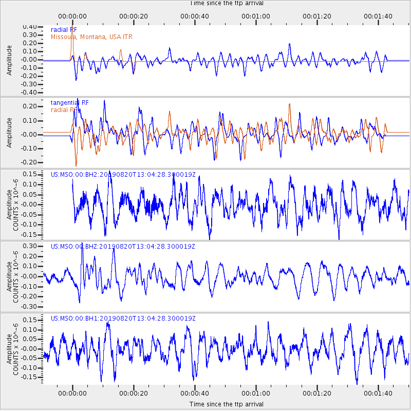
MSO Missoula, Montana, USA - Earthquake Result Viewer
*The percent match for this event was below the threshold and hence no stack was calculated.
| Earthquake location: |
Ryukyu Islands, Japan |
| Earthquake latitude/longitude: |
28.0/130.9 |
| Earthquake time(UTC): |
2019/08/20 (232) 12:52:22 GMT |
| Earthquake Depth: |
10 km |
| Earthquake Magnitude: |
5.2 Mww |
| Earthquake Catalog/Contributor: |
NEIC PDE/us |
|
| Network: |
US United States National Seismic Network |
| Station: |
MSO Missoula, Montana, USA |
| Lat/Lon: |
46.83 N/113.94 W |
| Elevation: |
1264 m |
|
| Distance: |
85.4 deg |
| Az: |
38.565 deg |
| Baz: |
306.569 deg |
| Ray Param: |
$rayparam |
*The percent match for this event was below the threshold and hence was not used in the summary stack. |
|
| Radial Match: |
44.935444 % |
| Radial Bump: |
400 |
| Transverse Match: |
69.27854 % |
| Transverse Bump: |
400 |
| SOD ConfigId: |
19053131 |
| Insert Time: |
2019-09-03 13:01:02.510 +0000 |
| GWidth: |
2.5 |
| Max Bumps: |
400 |
| Tol: |
0.001 |
|
Signal To Noise
| Channel | StoN | STA | LTA |
| US:MSO:00:BHZ:20190820T13:04:28.300019Z | 2.7897243 | 1.3440518E-7 | 4.8178663E-8 |
| US:MSO:00:BH1:20190820T13:04:28.300019Z | 0.6409441 | 4.0175372E-8 | 6.268155E-8 |
| US:MSO:00:BH2:20190820T13:04:28.300019Z | 1.0717962 | 6.444689E-8 | 6.01298E-8 |
| Arrivals |
| Ps | |
| PpPs | |
| PsPs/PpSs | |


