You are here: Home > Network List > UW - Pacific Northwest Regional Seismic Network Stations List
> Station UMAT Pilot Rock, OR, USA > Earthquake Result Viewer
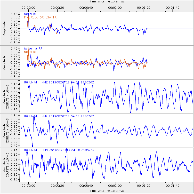
UMAT Pilot Rock, OR, USA - Earthquake Result Viewer
*The percent match for this event was below the threshold and hence no stack was calculated.
| Earthquake location: |
Ryukyu Islands, Japan |
| Earthquake latitude/longitude: |
28.0/130.9 |
| Earthquake time(UTC): |
2019/08/20 (232) 12:52:22 GMT |
| Earthquake Depth: |
10 km |
| Earthquake Magnitude: |
5.2 Mww |
| Earthquake Catalog/Contributor: |
NEIC PDE/us |
|
| Network: |
UW Pacific Northwest Regional Seismic Network |
| Station: |
UMAT Pilot Rock, OR, USA |
| Lat/Lon: |
45.29 N/118.96 W |
| Elevation: |
1318 m |
|
| Distance: |
83.4 deg |
| Az: |
41.842 deg |
| Baz: |
303.286 deg |
| Ray Param: |
$rayparam |
*The percent match for this event was below the threshold and hence was not used in the summary stack. |
|
| Radial Match: |
69.50476 % |
| Radial Bump: |
350 |
| Transverse Match: |
64.42566 % |
| Transverse Bump: |
400 |
| SOD ConfigId: |
19053131 |
| Insert Time: |
2019-09-03 13:01:30.960 +0000 |
| GWidth: |
2.5 |
| Max Bumps: |
400 |
| Tol: |
0.001 |
|
Signal To Noise
| Channel | StoN | STA | LTA |
| UW:UMAT: :HHZ:20190820T13:04:18.258026Z | 3.0502362 | 2.1474219E-7 | 7.0401825E-8 |
| UW:UMAT: :HHN:20190820T13:04:18.258026Z | 1.6479242 | 8.201474E-8 | 4.9768516E-8 |
| UW:UMAT: :HHE:20190820T13:04:18.258026Z | 1.9152882 | 1.2335293E-7 | 6.440437E-8 |
| Arrivals |
| Ps | |
| PpPs | |
| PsPs/PpSs | |


