You are here: Home > Network List > AV - Alaska Volcano Observatory Stations List
> Station MAPS Pakushin Southeast, Makushin Volcano, Alaska > Earthquake Result Viewer
MAPS Pakushin Southeast, Makushin Volcano, Alaska - Earthquake Result Viewer
*The percent match for this event was below the threshold and hence no stack was calculated.
| Earthquake location: |
Santa Cruz Islands |
| Earthquake latitude/longitude: |
-11.4/166.3 |
| Earthquake time(UTC): |
2019/08/20 (232) 13:03:52 GMT |
| Earthquake Depth: |
37 km |
| Earthquake Magnitude: |
6.0 Mww |
| Earthquake Catalog/Contributor: |
NEIC PDE/us |
|
| Network: |
AV Alaska Volcano Observatory |
| Station: |
MAPS Pakushin Southeast, Makushin Volcano, Alaska |
| Lat/Lon: |
53.81 N/166.94 W |
| Elevation: |
333 m |
|
| Distance: |
68.8 deg |
| Az: |
16.645 deg |
| Baz: |
208.272 deg |
| Ray Param: |
$rayparam |
*The percent match for this event was below the threshold and hence was not used in the summary stack. |
|
| Radial Match: |
55.163803 % |
| Radial Bump: |
277 |
| Transverse Match: |
54.1974 % |
| Transverse Bump: |
306 |
| SOD ConfigId: |
19053131 |
| Insert Time: |
2019-09-03 13:06:10.813 +0000 |
| GWidth: |
2.5 |
| Max Bumps: |
400 |
| Tol: |
0.001 |
|
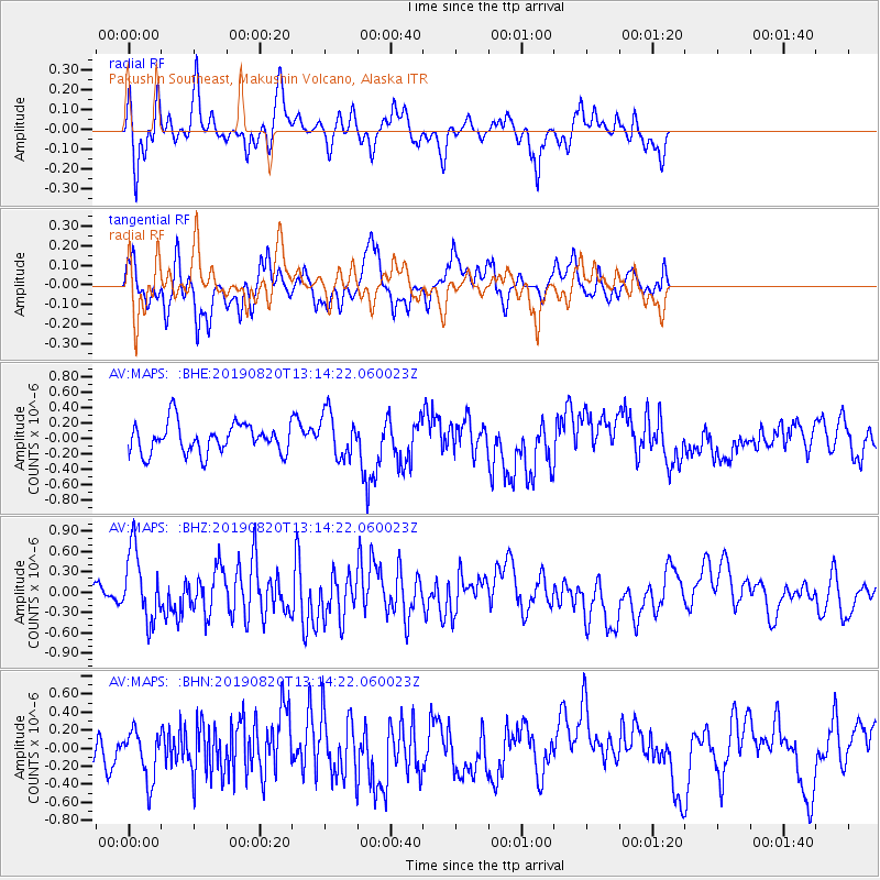
Signal To Noise
| Channel | StoN | STA | LTA |
| AV:MAPS: :BHZ:20190820T13:14:22.060023Z | 3.2103074 | 5.1995585E-7 | 1.6196451E-7 |
| AV:MAPS: :BHN:20190820T13:14:22.060023Z | 0.9697716 | 2.7270082E-7 | 2.8120107E-7 |
| AV:MAPS: :BHE:20190820T13:14:22.060023Z | 1.4754256 | 2.8599226E-7 | 1.9383712E-7 |
| Arrivals |
| Ps | |
| PpPs | |
| PsPs/PpSs | |


