You are here: Home > Network List > II - Global Seismograph Network (GSN - IRIS/IDA) Stations List
> Station WRAB Tennant Creek, NT, Australia > Earthquake Result Viewer
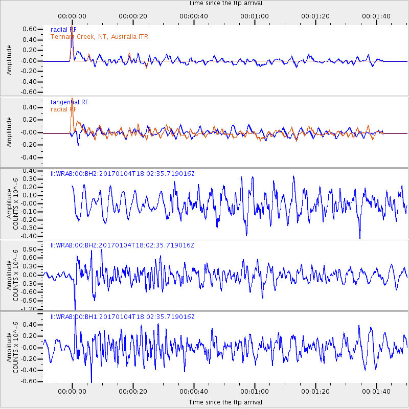
WRAB Tennant Creek, NT, Australia - Earthquake Result Viewer
*The percent match for this event was below the threshold and hence no stack was calculated.
| Earthquake location: |
Near East Coast Of Honshu, Japan |
| Earthquake latitude/longitude: |
37.1/141.3 |
| Earthquake time(UTC): |
2017/01/04 (004) 17:53:20 GMT |
| Earthquake Depth: |
10 km |
| Earthquake Magnitude: |
5.6 mb |
| Earthquake Catalog/Contributor: |
NEIC PDE/us |
|
| Network: |
II Global Seismograph Network (GSN - IRIS/IDA) |
| Station: |
WRAB Tennant Creek, NT, Australia |
| Lat/Lon: |
19.93 S/134.36 E |
| Elevation: |
366 m |
|
| Distance: |
57.1 deg |
| Az: |
187.824 deg |
| Baz: |
6.64 deg |
| Ray Param: |
$rayparam |
*The percent match for this event was below the threshold and hence was not used in the summary stack. |
|
| Radial Match: |
66.29558 % |
| Radial Bump: |
400 |
| Transverse Match: |
48.494053 % |
| Transverse Bump: |
353 |
| SOD ConfigId: |
1943534 |
| Insert Time: |
2017-01-18 17:54:55.984 +0000 |
| GWidth: |
2.5 |
| Max Bumps: |
400 |
| Tol: |
0.001 |
|
Signal To Noise
| Channel | StoN | STA | LTA |
| II:WRAB:00:BHZ:20170104T18:02:35.719016Z | 3.0839078 | 3.9955148E-7 | 1.2956014E-7 |
| II:WRAB:00:BH1:20170104T18:02:35.719016Z | 1.9309667 | 1.9682477E-7 | 1.0193069E-7 |
| II:WRAB:00:BH2:20170104T18:02:35.719016Z | 1.0845759 | 1.3039863E-7 | 1.2023007E-7 |
| Arrivals |
| Ps | |
| PpPs | |
| PsPs/PpSs | |


